Earth From Space: Classic NASA Photos (Gallery)
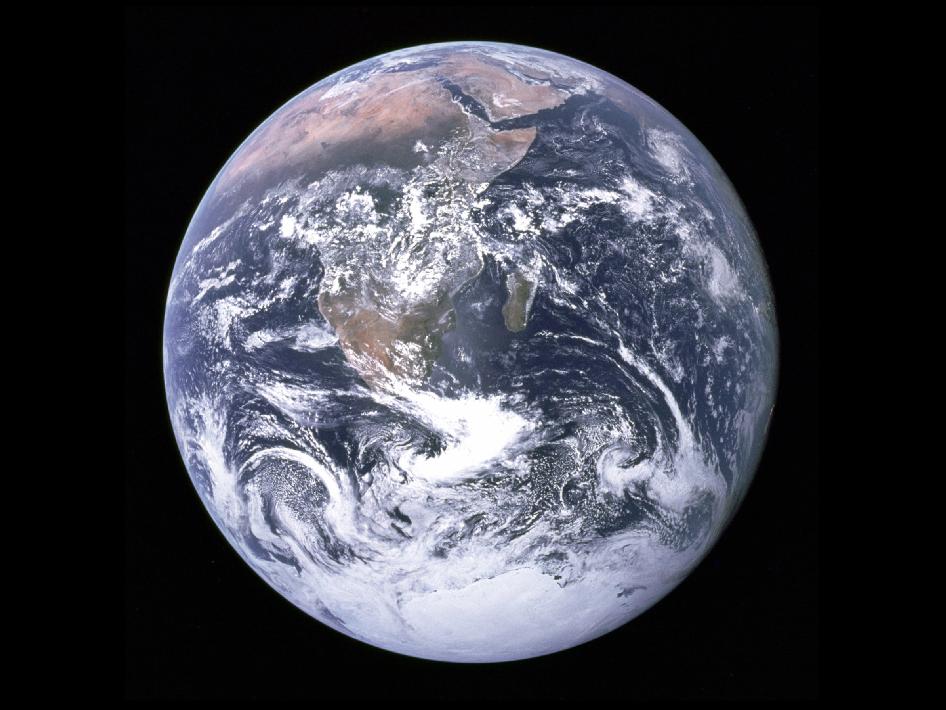
Whole Earth from Apollo 17
This image from Apollo 17, and others like it, captured whole hemispheres of water, land and weather. This photo was the first view of the south polar ice cap. Almost the entire coastline of Africa is visible, along with the Arabian Peninsula.
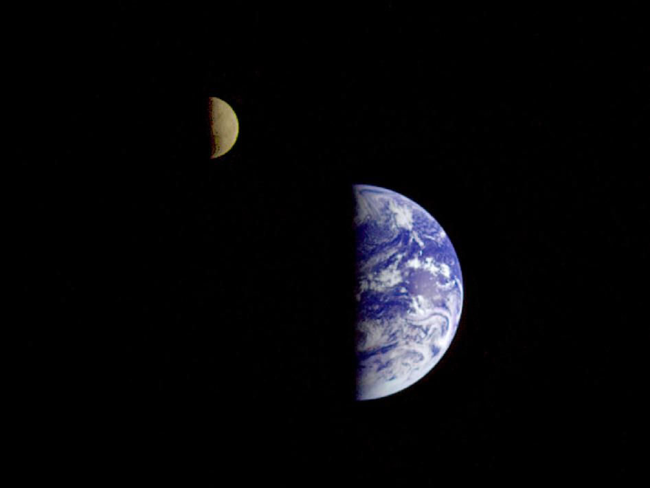
Earth and Moon
This picture of the Earth and Moon in a single frame was taken by the Galileo spacecraft from about 3.9 million miles away. Antarctica is visible through clouds (bottom). The Moon's far side is seen; the shadowy indentation in the dawn terminator is the south pole Aitken Basin, one of the largest and oldest lunar impact features.
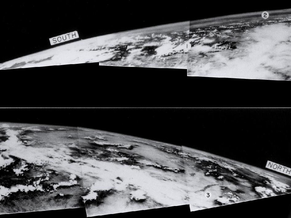
High Above
On March 7, 1947, not long after the end of World War II and years before Sputnik ushered in the space age, a group of soldiers and scientists in the New Mexico desert saw something new and wonderful in these grainy black-and-white-photos — the first pictures of Earth as seen from altitude greater than 100 miles in space.
Blue Marble from Suomi NPP
A “Blue Marble” image of the Earth taken from the VIIRS instrument aboard NASA's Earth-observing satellite — Suomi NPP. This composite image uses a number of swaths of the Earth's surface taken on Jan. 4, 2012.
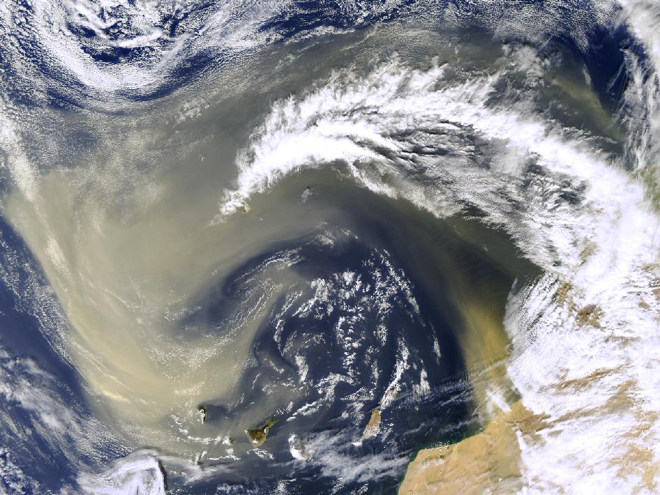
Saharan Dust Off Canary Islands
A graceful arc of Saharan dust is streaming off the coast of northwest Africa and sweeping out over the Atlantic Ocean and the Canary Islands in this Moderate Resolution Imaging Spectroradiometer (MODIS) image from the Aqua satellite on February 18, 2004.
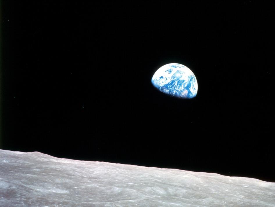
Earthrise from Apollo 8
Apollo 8, the first manned mission to the moon, entered lunar orbit on Christmas Eve, Dec. 24, 1968. That evening, the astronauts — Commander Frank Borman, Command Module Pilot Jim Lovell, and Lunar Module Pilot William Anders — held a live broadcast from lunar orbit, in which they showed pictures of the Earth and moon as seen from their spacecraft.
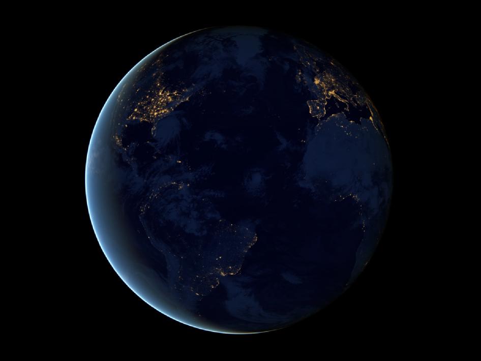
Black Marble Earth
This global view of Earth’s city lights is a composite assembled from data acquired by the Suomi National Polar-orbiting Partnership (Suomi NPP) satellite. The data was acquired over nine days in April 2012 and thirteen days in October 2012.
Breaking space news, the latest updates on rocket launches, skywatching events and more!
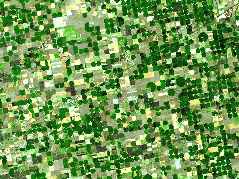
Finney County, Kansas
Finney County in southwestern Kansas is now irrigated cropland where once there was shortgrass prairie. The image shows center-pivot irrigation systems that are 800 and 1,600 meters in diameter (0.5 and 1 mile). The image was acquired on June 24, 2001, is centered near 37.4 degrees north latitude, 100.9 degrees west longitude, and covers an area of 37.2 x 38.8 km.
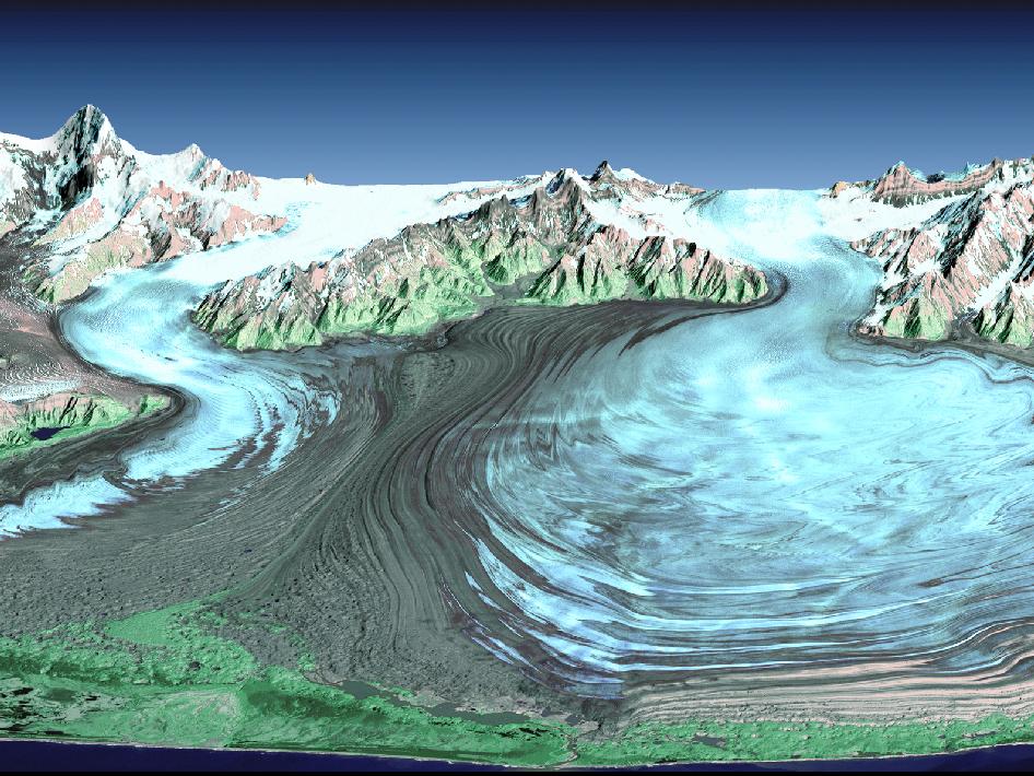
Malaspina Glacier in Southeastern Alaska
Malaspina Glacier in southeastern Alaska is considered the classic example of a piedmont glacier. Piedmont glaciers occur where valley glaciers exit a mountain range onto broad lowlands, are no longer laterally confined, and spread to become wide lobes. This perspective view was created from a Landsat satellite image and an elevation model generated by the Shuttle Radar Topography Mission (SRTM).
Robot Over the Horizon
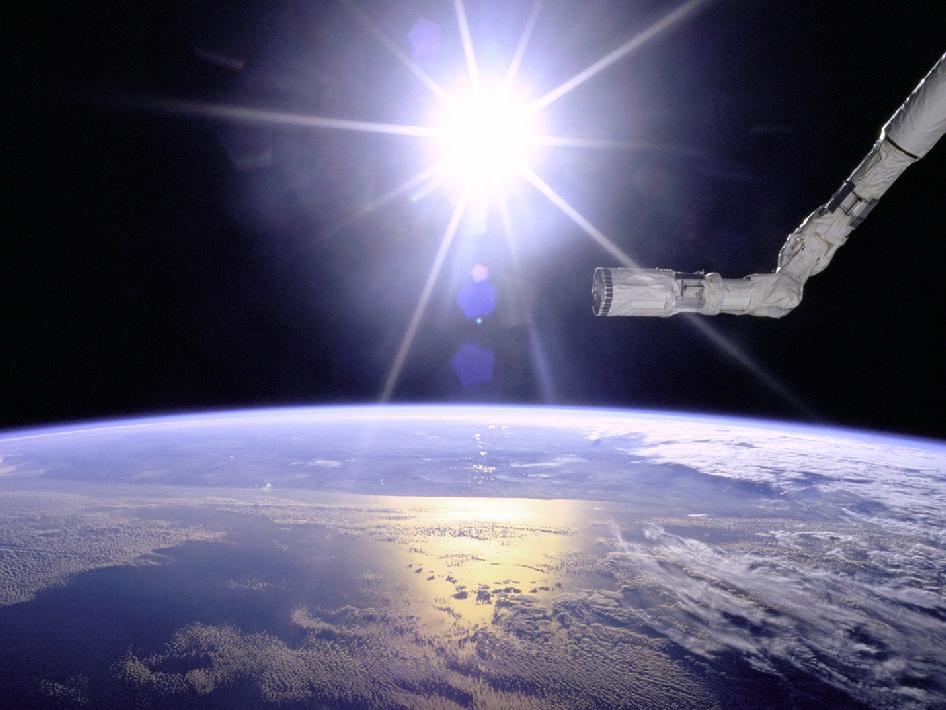
The Space Shuttle Endeavour's robotic arm hovers over Earth's horizon, backdropped by a starburst from the Sun. This photo was taken during the STS-77 shuttle mission in 1996.
Crater Highlands, Tanzania
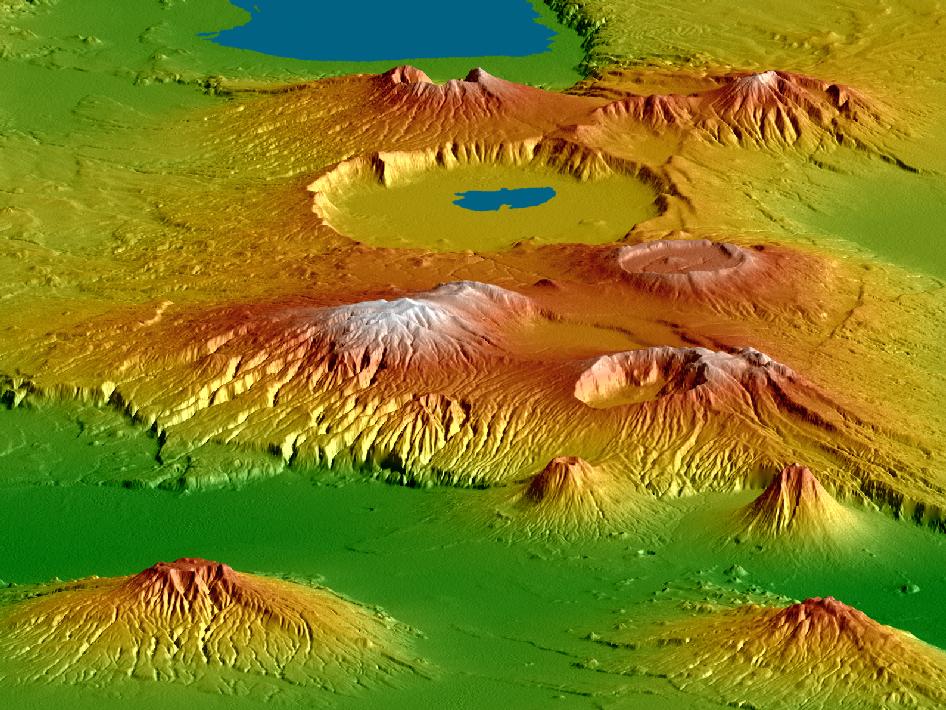
The Shuttle Radar Topography Mission (SRTM), flown aboard Space Shuttle Endeavour in February 2000, acquired elevation measurements for nearly all of Earth's landmass between 60°N and 56°S latitudes. SRTM data were used to generate this view of the Crater Highlands along the East African Rift in Tanzania. Lake Eyasi is depicted in blue at the top of the image, and a smaller lake occurs in Ngorongoro Crater.

Space.com is the premier source of space exploration, innovation and astronomy news, chronicling (and celebrating) humanity's ongoing expansion across the final frontier. Originally founded in 1999, Space.com is, and always has been, the passion of writers and editors who are space fans and also trained journalists. Our current news team consists of Editor-in-Chief Tariq Malik; Editor Hanneke Weitering, Senior Space Writer Mike Wall; Senior Writer Meghan Bartels; Senior Writer Chelsea Gohd, Senior Writer Tereza Pultarova and Staff Writer Alexander Cox, focusing on e-commerce. Senior Producer Steve Spaleta oversees our space videos, with Diana Whitcroft as our Social Media Editor.
