Antarctic sea ice hits 'record-smashing' low this year, satellite data shows
The Arctic also saw the sixth lowest minimum of sea ice on record.

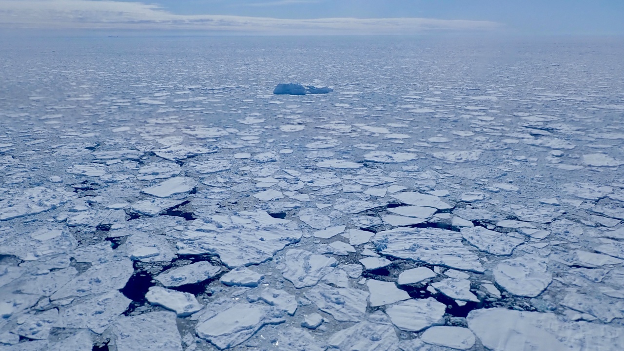
It's not a great year for polar sea ice. Both the Arctic and Antarctic have seen record lows in sea ice extent, according to NASA and the National Snow and Ice Data Center (NSIDC), which use satellite data to track sea ice across both polar regions.
Arctic sea ice likely reached its annual minimum extent this year on Sept. 19 at 1.63 million square miles (4.23 million square kilometers) — the sixth-lowest minimum in the satellite record. And in Antarctica, sea ice likely reached its maximum extent on Sept. 10 at 6.5 million square miles (16.96 million square kilometers) — the lowest maximum ever in the satellite record.
"It’s a record-smashing sea ice low in the Antarctic. Sea ice growth appears low around nearly the whole continent as opposed to any one region," Walt Meier, a sea ice scientist at NSIDC, said in a statement. And in the Arctic, he points out, the Northwest Passage has more open seas than usual.
"There also seems to be a lot more loose, lower concentration ice — even toward the North Pole — and areas that used to be pretty compact, solid sheets of ice through the summer," he said. "That’s been happening more frequently in recent years."
Related: Greenland ice sheets are weaker to climate change than we thought
Each year, sea ice grows and melts with the seasons, and its extent in both directions can be impacted by factors like wind patterns, ocean temperatures — directly correlated with human-induced global warming — and climate patterns like El Niño, which is occurring now.
One of the issues with low sea ice coverage is that it reinforces ocean warming due to the ice-albedo feedback cycle. Sea ice, being white, reflects the sun's energy back out into space, but dark open ocean absorbs it — as such, the waters may remain warmer, inhibiting sea ice growth further.
Breaking space news, the latest updates on rocket launches, skywatching events and more!
And while sea ice minimum and maximum extents are key measurements in the polar environment, the thickness of that sea ice is another major concern.
"Thickness at the end of the growth season largely determines the survivability of sea ice. New research is using satellites like NASA’s ICESat-2 (Ice, Cloud and land Elevation Satellite-2) to monitor how thick the ice is year-round," said Nathan Kurtz, lab chief of NASA’s Cryospheric Sciences Laboratory at the agency’s Goddard Space Flight Center.
"At NASA we’re interested in taking cutting-edge measurements, but we’re also trying to connect them to the historical record to better understand what’s driving some of these changes that we’re seeing," said Kurtz.

Space.com contributing writer Stefanie Waldek is a self-taught space nerd and aviation geek who is passionate about all things spaceflight and astronomy. With a background in travel and design journalism, as well as a Bachelor of Arts degree from New York University, she specializes in the budding space tourism industry and Earth-based astrotourism. In her free time, you can find her watching rocket launches or looking up at the stars, wondering what is out there. Learn more about her work at www.stefaniewaldek.com.
