Satellite photos show Dixie Fire's devastation to California town in before-and-after views
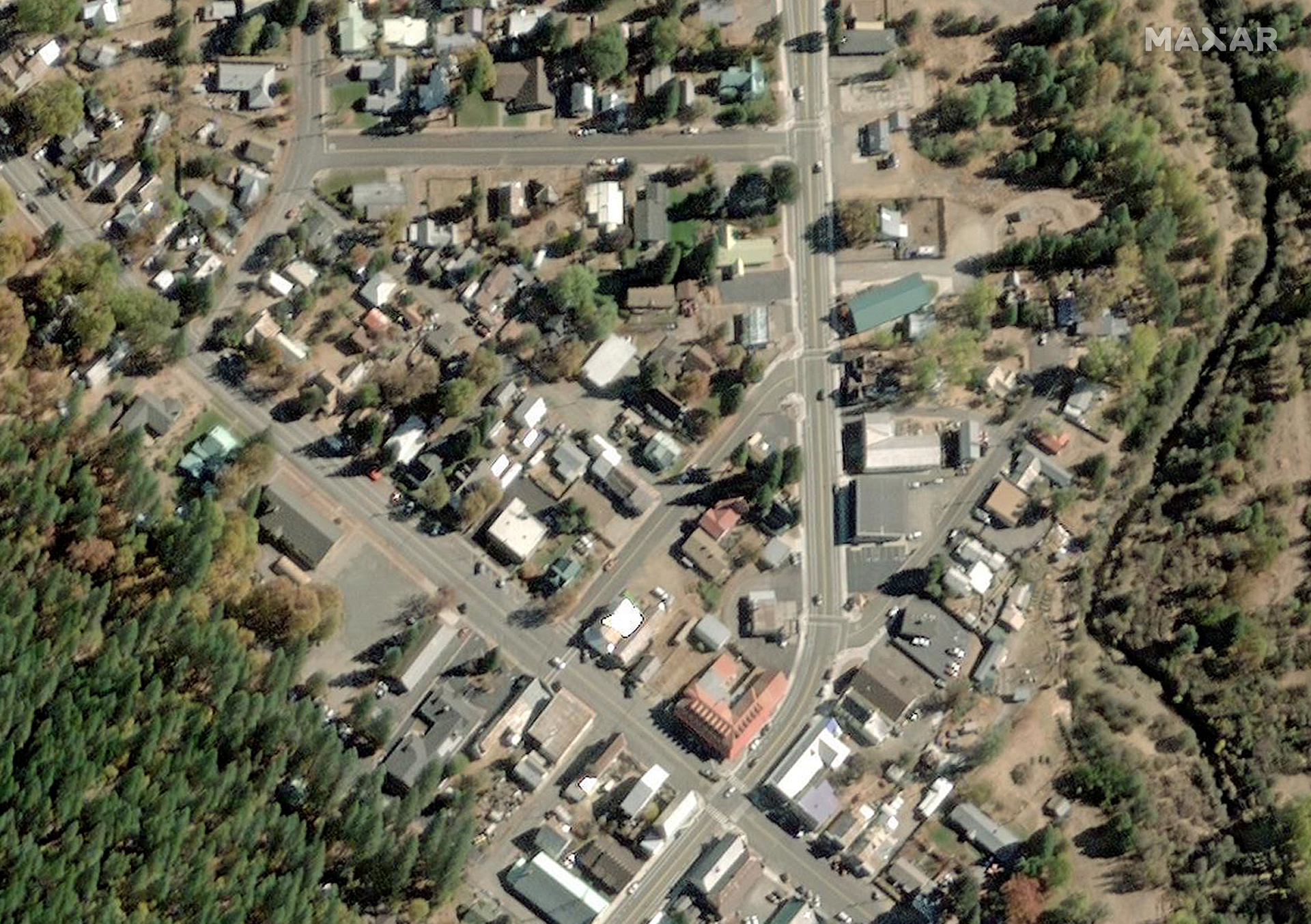
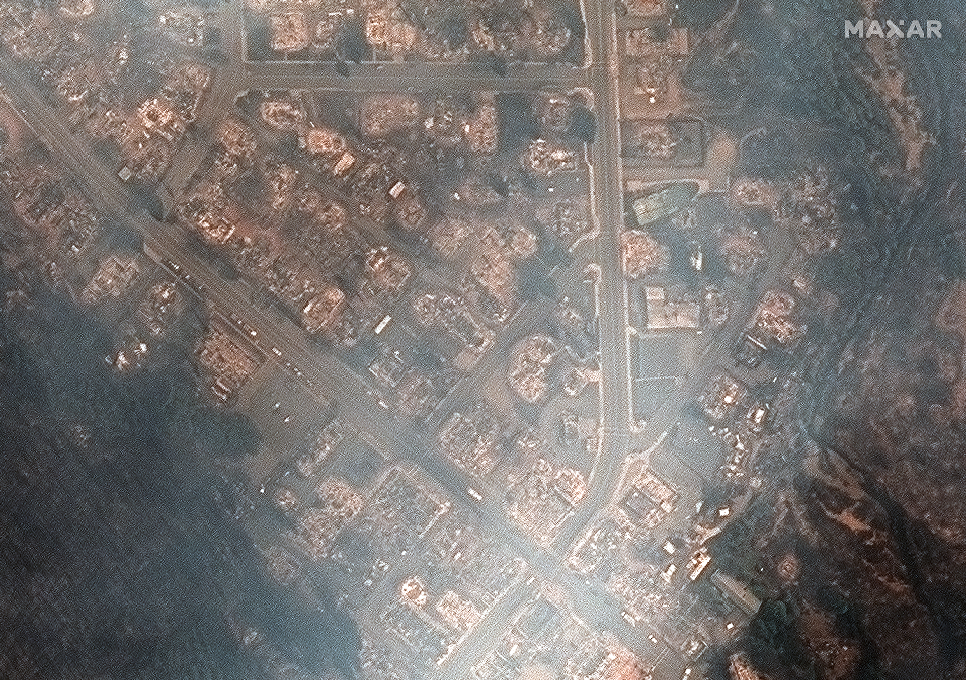
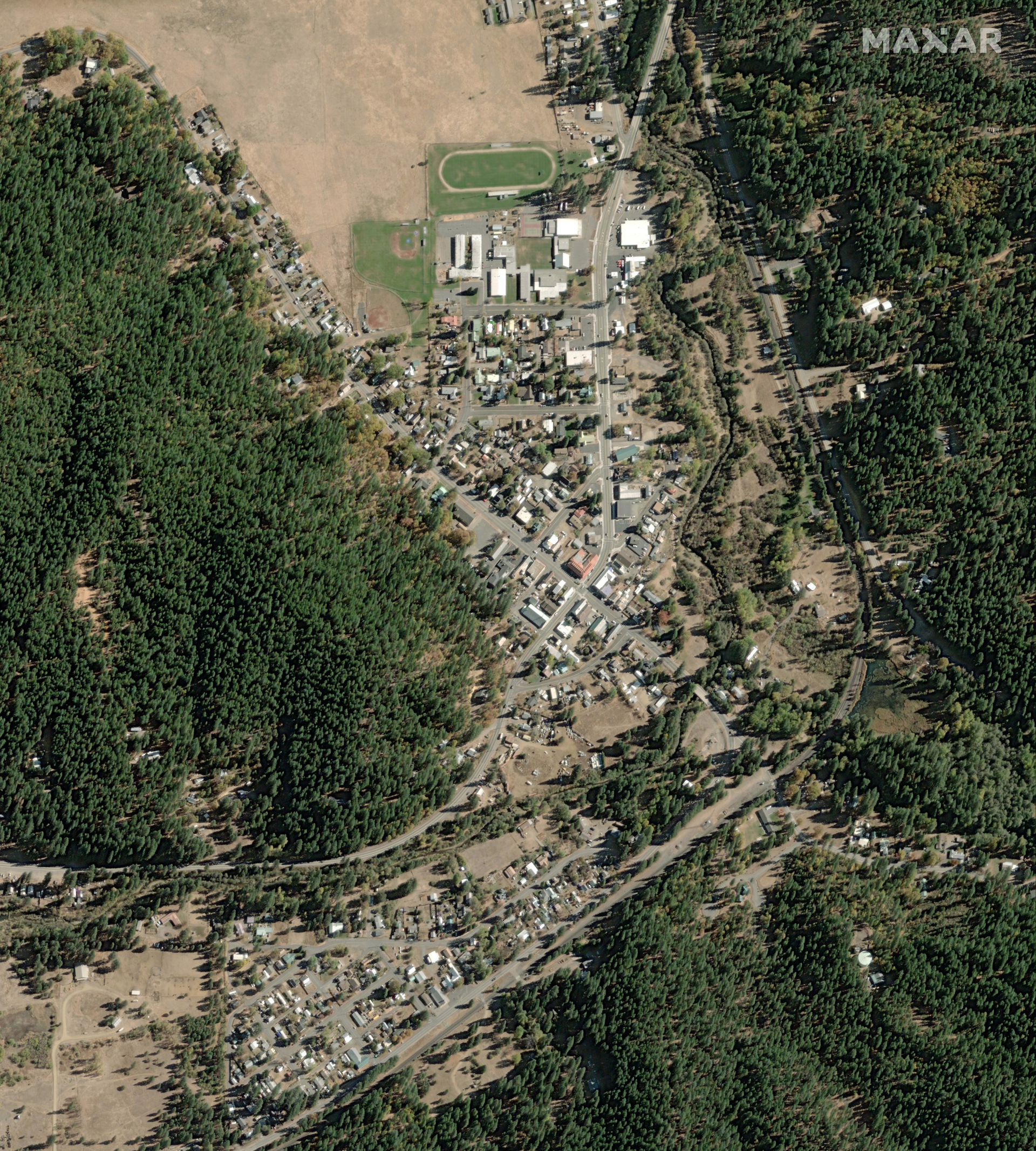
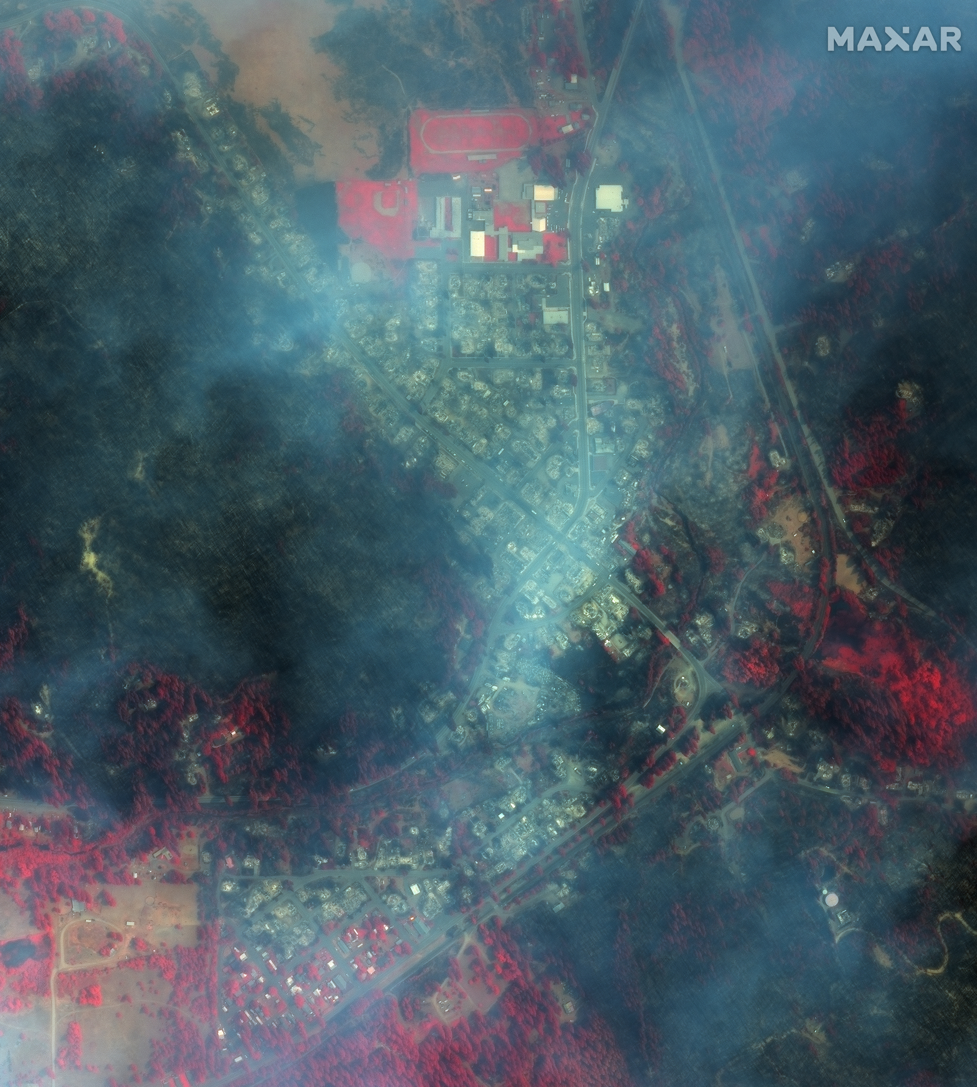
Most of Greenville, Calif. was destroyed by the Dixie wildfire of August 2021.

Breaking space news, the latest updates on rocket launches, skywatching events and more!
You are now subscribed
Your newsletter sign-up was successful
Want to add more newsletters?

Delivered daily
Daily Newsletter
Breaking space news, the latest updates on rocket launches, skywatching events and more!

Once a month
Watch This Space
Sign up to our monthly entertainment newsletter to keep up with all our coverage of the latest sci-fi and space movies, tv shows, games and books.

Once a week
Night Sky This Week
Discover this week's must-see night sky events, moon phases, and stunning astrophotos. Sign up for our skywatching newsletter and explore the universe with us!

Twice a month
Strange New Words
Space.com's Sci-Fi Reader's Club. Read a sci-fi short story every month and join a virtual community of fellow science fiction fans!
The ashes of a California town spotted from orbit Monday (Aug. 9) show the devastating impact of the ongoing Dixie wildfire in the United States west.
At least 75 percent of Greenville, Calif. succumbed after the massive blaze tore through the town, according to NBC News. Satellite imagery from Maxar Technologies shows just how badly the town was hurt.
Maxar’s WorldView-1 satellite collected black-and-white satellite imagery that shows how the town looks as the smoke clears. Other Maxar imagery provided color infrared data as the fire ripped through the town; burned areas appear as black or grey, and non-burned vegetation shows as shades of red or pink, officials said.


Global warming is increasing the devastation and power of wildfires around the world. The record-breaking blazes are triggered by heatwaves and have been recorded in 2021 on three continents.
Earth observation satellites, including those from private companies and those from government, have been tracking the fires to assist the affected populations as best as possible.
In Europe, Mediterranean Sea countries such as Greece, Turkey and Italy were forced to evacuate residents and tourists alike from popular vacation destinations. Siberia, the sparsely inhabited region in the north-east of Russia, has seen wildfires break annual records for fire-related emissions of greenhouse gases.


In the U.S., the Dixie Fire became the largest wildfire in the history of California, having destroyed more than 700 square miles (1,811 square kilometers) of land (as of Aug. 8).
Breaking space news, the latest updates on rocket launches, skywatching events and more!
The Dixie Fire began on July 13 in northern California and remains out of control despite weeks of efforts on the part of firefighters and emergency officials, who are using tools ranging from drones to satellites to modeling to fight the devastating blaze.
Follow Elizabeth Howell on Twitter @howellspace. Follow us on Twitter @Spacedotcom and on Facebook.

Elizabeth Howell (she/her), Ph.D., was a staff writer in the spaceflight channel between 2022 and 2024 specializing in Canadian space news. She was contributing writer for Space.com for 10 years from 2012 to 2024. Elizabeth's reporting includes multiple exclusives with the White House, leading world coverage about a lost-and-found space tomato on the International Space Station, witnessing five human spaceflight launches on two continents, flying parabolic, working inside a spacesuit, and participating in a simulated Mars mission. Her latest book, "Why Am I Taller?" (ECW Press, 2022) is co-written with astronaut Dave Williams.
