'Sonar Anomaly' Isn't a Shipwreck, and It's Definitely Not Aliens, NOAA Says
The suspenseful wait is over: The unusual "sonar anomaly" detected by an aquatic robot off the coast of North Carolina isn't a shipwreck, and it isn't aliens, according to the National Oceanic and Atmospheric Administration (NOAA).
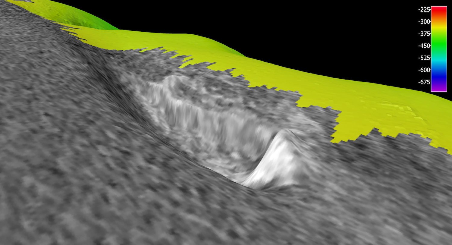
Rather, it's "geologic in origin," NOAA Ocean Explorer reported in a tweet yesterday (June 27).
The finding, although not surprising, is a bit of a letdown after NOAA tweeted earlier that day that the anomaly could be "an archaeology site, a geological formation or otherwise!" [Photos: Colonial-Age Shipwrecks Found Off Cape Canaveral Coast]
Scientists aboard NOAA's Okeanos Explorer noticed the anomaly while mapping the seafloor off the coast of North Carolina. They dubbed the site the "Big Dipper" anomaly and promptly sent a remotely operated vehicle (ROV) underwater to investigate.
Given that North Carolina's coast is called the "Graveyard of the Atlantic," because of the many shipwrecks discovered in the area, NOAA scientists initially speculated that the anomaly could be the remains of a long-lost ship, according to The Charlotte Observer.
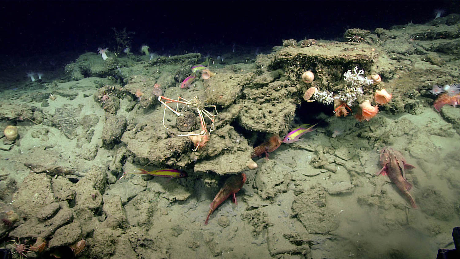
But the ROV found otherwise. The anomaly turned out to be a "rocky feature," NOAA said in a tweet. On the upside, this feature "is great habitat for many species, including the many fish already seen," NOAA noted.
The Okeanos Explorer's current expedition — called Windows to the Deep 2018: Exploration of the Southeast U.S. Continental Margin— is helping NOAA researchers map the seafloor in unknown and poorly understood deepwater areas of the southeastern United States, according to the expedition's mission plan. The expedition began on May 22 and runs through July 2.
Breaking space news, the latest updates on rocket launches, skywatching events and more!
Parts of the expedition included mapping "unexplored areas of the Blake Plateau, Blake Ridge, Blake Escarpment, submarine canyons offshore of North Carolina, submerged cultural heritage sites, areas predicted to be suitable habitat for deep-sea corals and sponges, inter-canyon areas, and gas seeps," NOAA said.
Meanwhile, the ROV dives are helping scientists understand the "diversity and distribution of deepwater habitats in this region," NOAA said.
However, aliens and unknown shipwrecks don't seem to be a part of that underwater world, at least not yet.
Original article on Live Science.

Laura is an editor at Live Science. She edits Life's Little Mysteries and reports on general science, including archaeology and animals. Her work has appeared in The New York Times, Scholastic, Popular Science and Spectrum, a site on autism research. She has won multiple awards from the Society of Professional Journalists and the Washington Newspaper Publishers Association for her reporting at a weekly newspaper near Seattle. Laura holds a bachelor's degree in English literature and psychology from Washington University in St. Louis and an advanced certificate in science writing from NYU.


