Monster Hurricane Irma Looms in New Satellite Video
Breaking space news, the latest updates on rocket launches, skywatching events and more!
You are now subscribed
Your newsletter sign-up was successful
Want to add more newsletters?

Delivered daily
Daily Newsletter
Breaking space news, the latest updates on rocket launches, skywatching events and more!

Once a month
Watch This Space
Sign up to our monthly entertainment newsletter to keep up with all our coverage of the latest sci-fi and space movies, tv shows, games and books.

Once a week
Night Sky This Week
Discover this week's must-see night sky events, moon phases, and stunning astrophotos. Sign up for our skywatching newsletter and explore the universe with us!

Twice a month
Strange New Words
Space.com's Sci-Fi Reader's Club. Read a sci-fi short story every month and join a virtual community of fellow science fiction fans!
As Hurricane Irma begins to batter islands in the Caribbean early Wednesday morning (Sept. 6), NASA and the National Oceanic and Atmospheric Administration (NOAA) are monitoring the colossal storm from space using a suite of weather satellites.
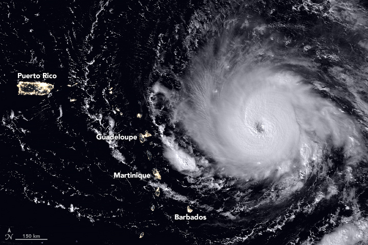
Hurricane Irma — a Category 5 storm packing winds of up to 185 mph (300 km/h) — first made landfall over the Caribbean island of Barbuda around 2 a.m. EDT today (Sept. 6). Over the next few hours, the eye of the storm continued to creep west-northwestward at a steady pace of about 16 mph (26 km/h), the National Hurricane Center reported. By 8 a.m. EDT (1200 GMT), the storm had ravaged the islands of Anguilla and St. Martin/Sint Maarten.
Watching the storm from a safe distance of many miles above the Earth are several NASA and NOAA satellites, including the GOES East weather satellite, the Suomi National Polar-orbiting Partnership (NPP) satellite and the Global Precipitation Measurement Mission (GPM). [Hurricane Irma in Photos: Views from Space of a Monster Storm]
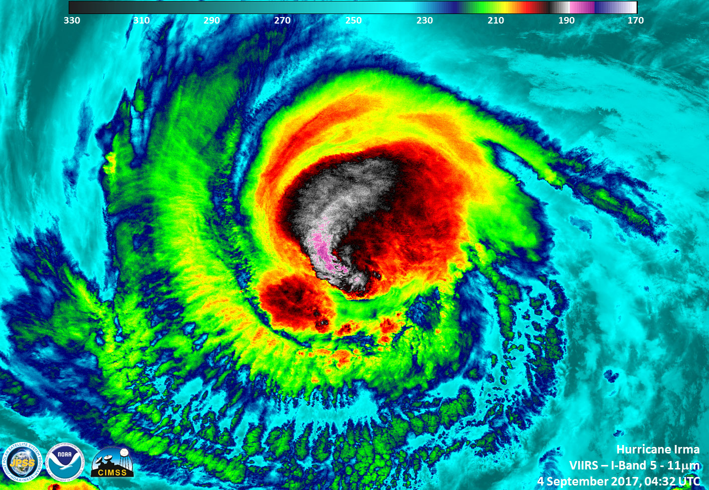
The Suomi NPP satellite flew over Hurricane Irma on Monday (Sept. 4) at approximately 12:32 a.m. EDT (0432 GMT), when Irma was just a Category 3 storm. Data from the satellite's Visible Infrared Imaging Radiometer Suite (VIIRS) revealed "very cold, very high, powerful thunderstorms on Irma's western side," NASA officials said in a statement.
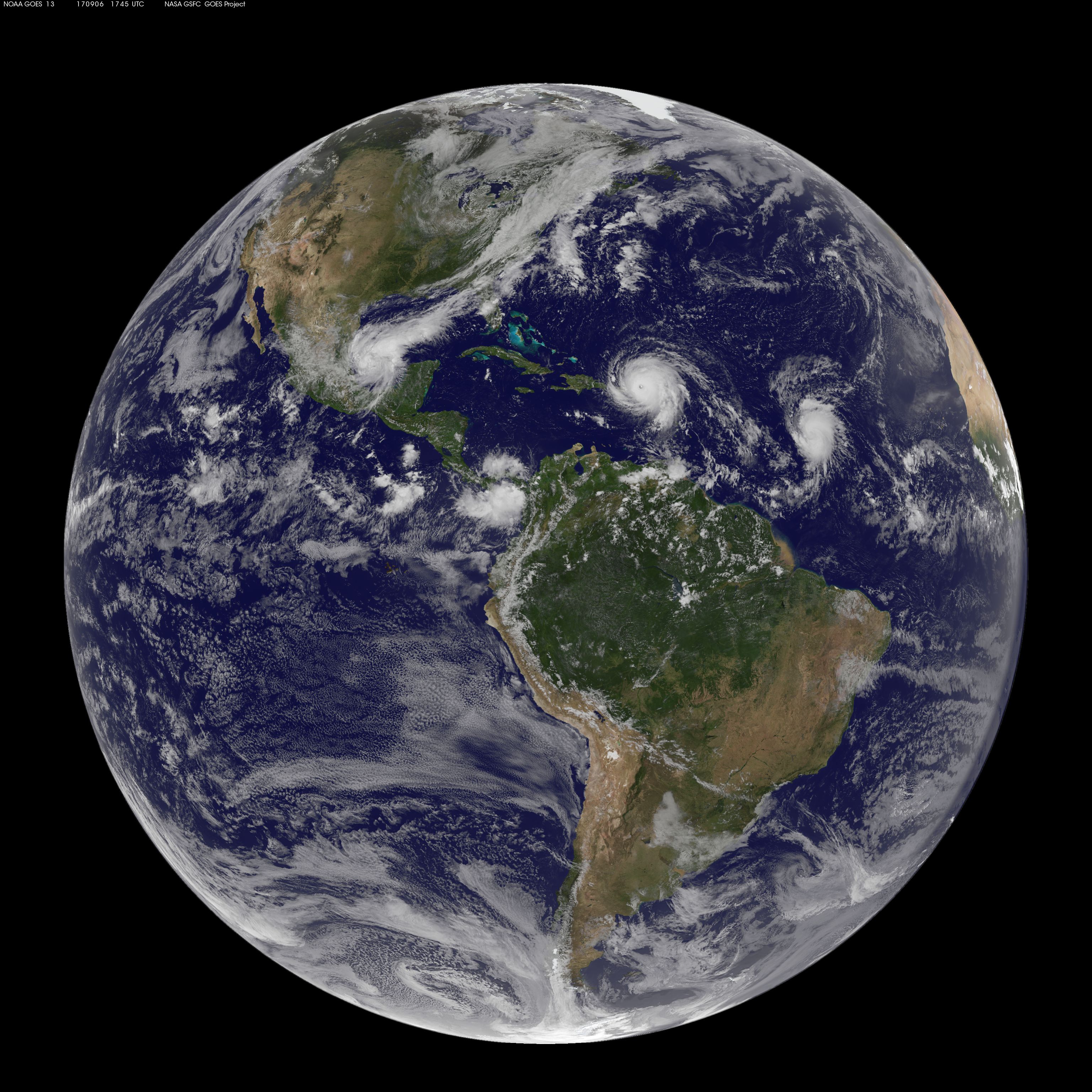
Early Wednesday morning (Sept. 6), the NASA-NOAA weather satellite GOES East showed what had become a Category 5 hurricane making landfall on the first of the Caribbean islands affected by this monstrous storm. And to make matters worse, another weather system, named Tropical Storm Jose, can be seen moving in a similar path as Hurricane Irma, and this storm may become a hurricane as well, the National Hurricane Center reported.
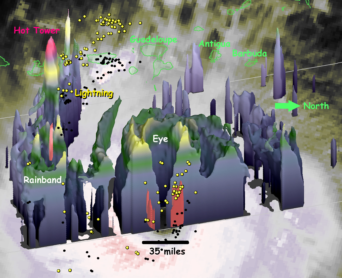
A joint mission between NASA and the Japan Aerospace Exploration Agency (JAXA) has been measuring the rainfall associated with Hurricane Irma. The Global Precipitation Measurement (GPM) satellite also provided a 3D view of the heat engine that fuels the storm.
"Under the central ring of clouds that circles the eye, water that had evaporated from the ocean surface condenses, releases heat and powers the circling winds of the hurricane," NASA officials said in a statement. "The radar on the GPM satellite is able to estimate how much water is falling as precipitation inside of the hurricane, which serves as a guide to how much energy is being released inside the hurricane's central heat engine."
Breaking space news, the latest updates on rocket launches, skywatching events and more!
The National Hurricane Center warned that rainfall from Irma "may cause life-threatening flash floods and mudslides." As of this morning, a hurricane warning remains in effect for the islands of Anguilla, St. Martin/Sint Maarten, the Virgin Islands, Puerto Rico and the Bahamas, along with several other small islands in the area.
Editor's Note: Space.com senior producer Steve Spaleta contributed to this report.
Email Hanneke Weitering at hweitering@space.com or follow her @hannekescience. Follow us @Spacedotcom, Facebook and Google+. Original article on Space.com.

Hanneke Weitering is a multimedia journalist in the Pacific Northwest reporting on the future of aviation at FutureFlight.aero and Aviation International News and was previously the Editor for Spaceflight and Astronomy news here at Space.com. As an editor with over 10 years of experience in science journalism she has previously written for Scholastic Classroom Magazines, MedPage Today and The Joint Institute for Computational Sciences at Oak Ridge National Laboratory. After studying physics at the University of Tennessee in her hometown of Knoxville, she earned her graduate degree in Science, Health and Environmental Reporting (SHERP) from New York University. Hanneke joined the Space.com team in 2016 as a staff writer and producer, covering topics including spaceflight and astronomy. She currently lives in Seattle, home of the Space Needle, with her cat and two snakes. In her spare time, Hanneke enjoys exploring the Rocky Mountains, basking in nature and looking for dark skies to gaze at the cosmos.
