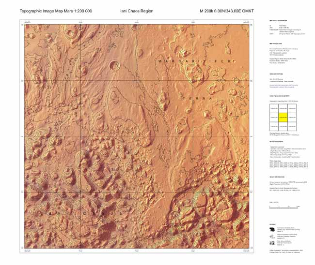
'Hiker's Maps' of Mars Created

When spacetravelers finally traipse across the dusty Martian surface, they'll knowjust what kind of terrain to expect thanks to scientists at the European SpaceAgency who are producing the first "hiker's maps" of the red planet.
The newtopographic maps, based on data collected by the ESA's MarsExpress spacecraft, could become the standard cartographic reference forfuture Martian research, as well as explorationon foot.
The ESAeventually will create topographic maps for the entire surface of Mars, which would mean more than 10,000maps each of equal area.
Forstarters, researchers have created a map of the Iani Chaos region, chosen forthe rock "islands" that litter the landscape in an interesting,chaotic pattern. These rocks are likely the remains of a previous Martiansurface that collapsed when the icesupporting subsurface cavities melted from volcanicheat.
All the mapswill feature the names of geologicalfeatures and detailed height contours of the landscape.
Contourlines are superimposed onto high-resolution images of Mars taken by theHigh-Resolution Stereo Camera (HRSC) onboard Mars Express. The lines help theeye to follow the morphology of the surface.
The data havealso been transformed into 3-Dcomputer models of Mars's surface.
Breaking space news, the latest updates on rocket launches, skywatching events and more!
- Mars Madness: A Multimedia Adventure!
- Image: Where Floods Once Flowed
- Images: Mars Express Discoveries
- All About Mars

Space.com is the premier source of space exploration, innovation and astronomy news, chronicling (and celebrating) humanity's ongoing expansion across the final frontier. Originally founded in 1999, Space.com is, and always has been, the passion of writers and editors who are space fans and also trained journalists. Our current news team consists of Editor-in-Chief Tariq Malik; Editor Hanneke Weitering, Senior Space Writer Mike Wall; Senior Writer Meghan Bartels; Senior Writer Chelsea Gohd, Senior Writer Tereza Pultarova and Staff Writer Alexander Cox, focusing on e-commerce. Senior Producer Steve Spaleta oversees our space videos, with Diana Whitcroft as our Social Media Editor.
