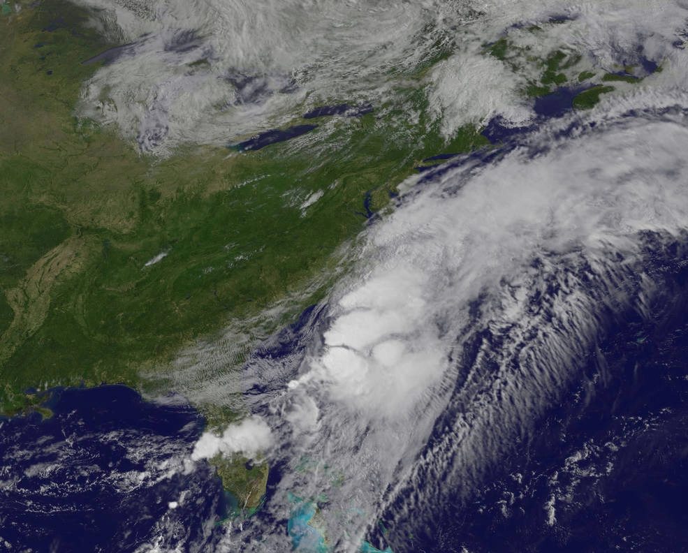
New satellite photos show the former Tropical Storm Colin surging across Florida and into the Atlantic Ocean this morning (June 7).
Colin churned northeast through the Gulf of Mexico before making landfall in Florida's "Big Bend" region late Monday night (June 6). The storm soon popped free into the Atlantic, and by 8 a.m. EDT (1200 GMT) today, Colin was about 45 miles (75 kilometers) south of Wilmington, North Carolina, NASA officials said.
The storm's progress has been tracked by a number of Earth-observing satellites, including NASA's Terra and Aqua spacecraft and the National Oceanic and Atmospheric Administration's (NOAA) GOES-East satellite.

Terra and GOES-East captured detailed visible-light imagery of Colin, while Aqua gathered infrared data showing that the maelstrom hosts strong thunderstorms, NASA officials said.
According to the latest update from NOAA's National Hurricane Center (NHC) in Miami, which was published at 5 p.m. EDT (2100 GMT) today, Colin is moving northeast at about 40 mph (65 km/h), with maximum sustained winds near 60 mph (97 km/h).
"This general motion is expected to continue through Wednesday night," the update reads. "Some slight strengthening is possible today and tonight, but gradual weakening is expected to begin on Wednesday."

The storm is expected to bring 1 to 2 inches (2.5 to 5 centimeters) of additional rainfall to far-eastern North Carolina through this evening, and 1 to 3 extra inches (2.5 to 7.5 cm) of rain across central Florida during the same period, according to previous NHC updates. Some parts of Florida, however, could receive up to 5 inches (12.5 cm) of additional rainfall.
Colin was classified as a tropical storm while in the Gulf of Mexico and cruising across Florida, but it was downgraded to a post-tropical cyclone shortly after moving into the Atlantic Ocean. (Post-tropical cyclones no longer have "sufficient tropical characteristics" to be considered tropical storms, NOAA officials have said.)
Colin never reached the status of hurricane, a term used for intense tropical cyclones with maximum sustained winds of at least 74 mph (119 km/h).
Follow Mike Wall on Twitter @michaeldwall and Google+. Follow us @Spacedotcom, Facebook or Google+. Originally published on Space.com.
