Storms That Spawned Deadly Oklahoma Tornadoes Seen from Space (Video)

Breaking space news, the latest updates on rocket launches, skywatching events and more!
You are now subscribed
Your newsletter sign-up was successful
Want to add more newsletters?
The beginnings of Monday's (May 20) disastrous tornado in Oklahoma were caught from space by a weather satellite in orbit.
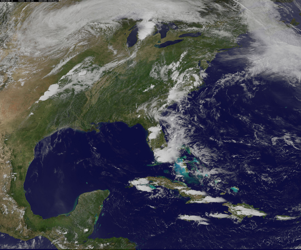
The GOES-13 satellite, which is operated by NASA and the National Oceanic and Atmospheric Administration (NOAA), imaged the movement of storm systems in the south-central United States between May 19 and 20, including the storm that sparked a tornado in Moore, Okla., estimated to be an EF-4 in strength, on Monday at 2:56 p.m. CDT (3:56 p.m. EDT, or 1956 GMT).
The tornado barreled through Moore, a city of about 55,000 people that lies within the Oklahoma City Metropolitan Area, with winds that were likelybetween 166 and 200 mph (267 and 322 km/h), given its estimated strength, killing dozens and destroying property over a 20-mile-long (32 kilometers) stretch of land. The system that generated that twister can be seen toward the end of the tornado video footage, according to officials at NASA's Goddard Space Flight Center in Greenbelt, Md.
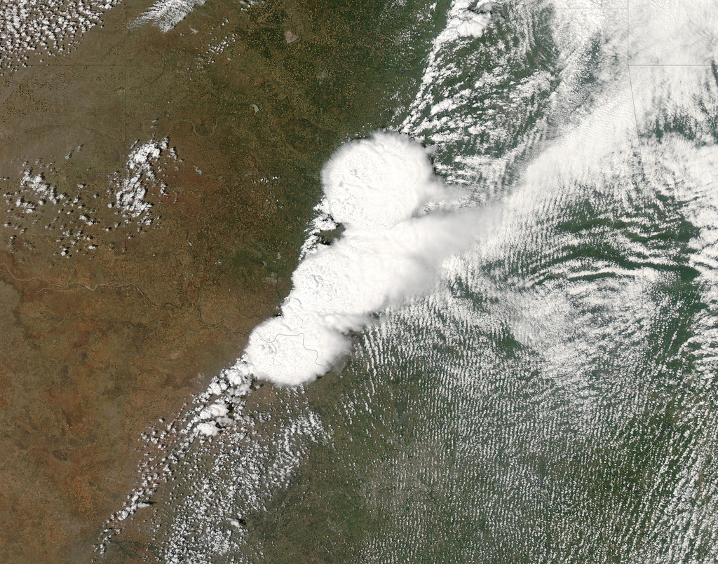
Article continues belowNASA'S MODIS satellite also caught sight of the storm clouds that generated the Moore tornado in an image captured at 2:40 p.m. CDT (3:40 p.m. EDT, or 1940 GMT).
The GOES-13 video shows storm systems that sparked other tornadoes in the Midwest from Monday afternoon into the evening. Several separate tornadoes developed in Kansas, Iowa and Oklahoma, and the storms extended along an extended path from Texas up through Minnesota.
Residents in Moore, the worst-hit city, were warned of the possibility of tornadoes for days in advance by local National Weather Service offices; a tornado warning was issued 16 minutes before the tornado actually formed.
This was the fourth tornado in 14 years to strike the town of Moore directly, and the first tornado outbreak reported in Iowa since late May 2012.
Breaking space news, the latest updates on rocket launches, skywatching events and more!
Follow Clara Moskowitz on Twitter and Google+. Follow us @Spacedotcom, Facebook and Google+. Original article on SPACE.com.

Clara Moskowitz is a science and space writer who joined the Space.com team in 2008 and served as Assistant Managing Editor from 2011 to 2013. Clara has a bachelor's degree in astronomy and physics from Wesleyan University, and a graduate certificate in science writing from the University of California, Santa Cruz. She covers everything from astronomy to human spaceflight and once aced a NASTAR suborbital spaceflight training program for space missions. Clara is currently Associate Editor of Scientific American. To see her latest project is, follow Clara on Twitter.

