NASA Photos: Raging Arizona Wildfires Seen From Space
Wallow North and Horseshoe Two Fires
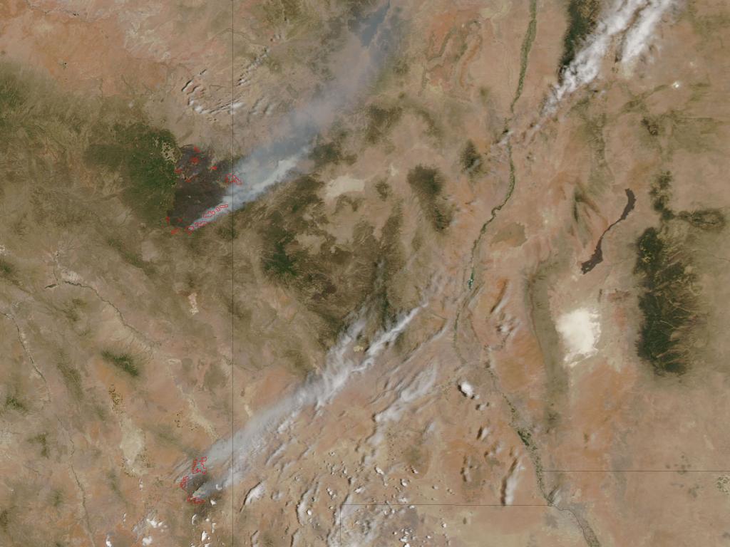
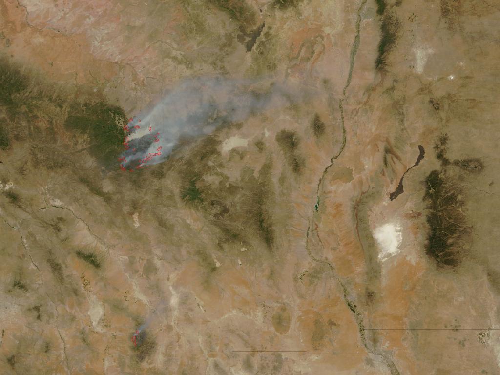
Fire conditions on June 13, 2011, in eastern Arizona are beginning to reach a plateau. The Wallow North fire is now 18 percent contained and the Horseshoe Two fire is 53 percent contained, according to InciWeb.
On June 12 the Wallow North fire crossed the state line into western New Mexico, reported the Arizona Republic. InciWeb reported that local utility companies continue to repair power lines and poles in areas around the Horseshoe Two fire that are now safe. The Horseshoe Two fire is located in eastern Arizona, south of the Wallow fire. The USDA Forest Service reported today that the Wallow North fire has burned 452,155 Acres and the Horseshoe Two fire has burned 157,254 acres.
The Honey Praire Complex fires in Georgia and Florida
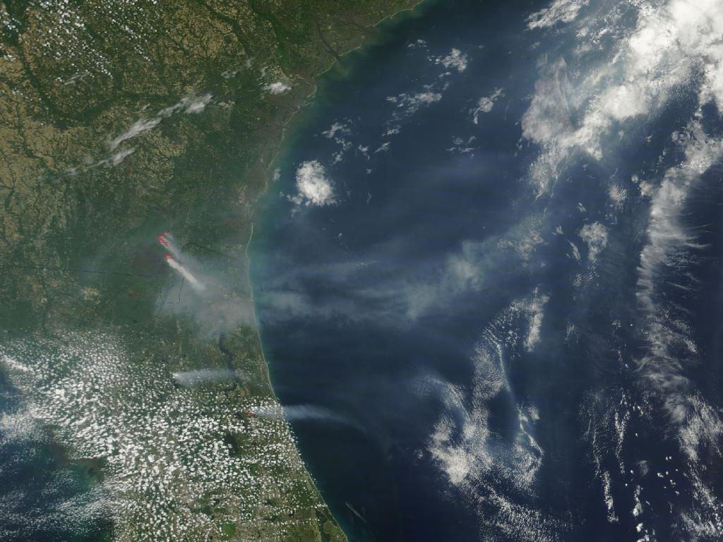
On June 13, 2011, NASA’s satellite imagery captured isolated fire incidents in Georgia and Florida. Remnants of the fires at the Okefenokee Swamp continue to burn in southern Georgia, and smaller brush fires have emerged in Central Florida due to dry weather.
Wallow North and Horseshoe Two Fires
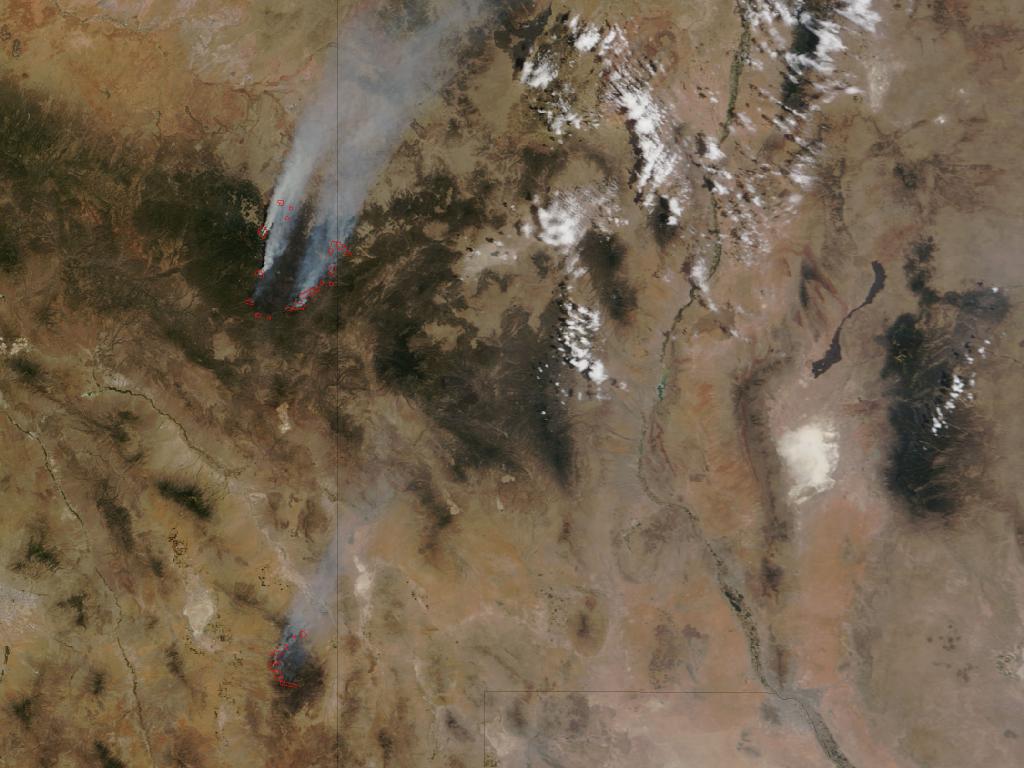
Blazing conditions persist in eastern Arizona. The information system estimated that the Horseshoe Two fire will be fully contained June 22.
Smoke streaming from each fire is shown in this image, taken on June 12, 2011.
The White Mountain Joint Information System reported that fire officials allowed residents of Eagar, South Fork and Springerville area to return to their homes, but warned of unhealthy air conditions because of the smoke. Coronado National Forest, Chiricahua National Monument and the Rincon district of Saguaro National Park are closed due to the Horseshoe Two fire, according to the Arizona Republic.
Wallow North and Horseshoe Two Fires
Over the weekend of June 11-12, Firefighters were still trying to make progress in battling Arizona’s massive Wallow Fire and the Horseshoe 2 fires that are spreading smoke through the south central U.S.
Wallow Fire, Arizona
By the end of the day on June 9, 2011, Arizona’s massive Wallow Fire had reached 386,690 acres (609 square miles or 157,701 hectares) and had burned 29 and threatened 5,242 homes. Most of the homes destroyed were in Greer. Approximately 3,012 people are working to contain the fire, which is now just five percent contained. Calmer winds on June 10 should help firefighters make more progress on containing the fire, said InciWeb.
Smoke from Arizona Fires Moving Over U.S.
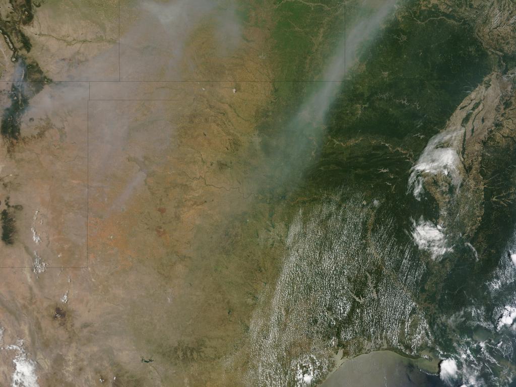
Smoke from Arizona fires, including the Wallow Fire, continued traveling toward the northeast on June 8, 2011. As seen in this image, thick smoke stretched from New Mexico and Texas northeastward to Illinois.
On June 8, 2011, the U.S. Air Quality “Smog Blog” reported that wildfires in eastern Arizona affected air quality throughout much of the eastern United States. The thickest smoke occurred over the Plains States, but thinner smoke plumes reached Quebec, Canada, and stretched to the Atlantic Ocean off New England.
NASA Tracks Carbon Monoxide from Wallow Fire
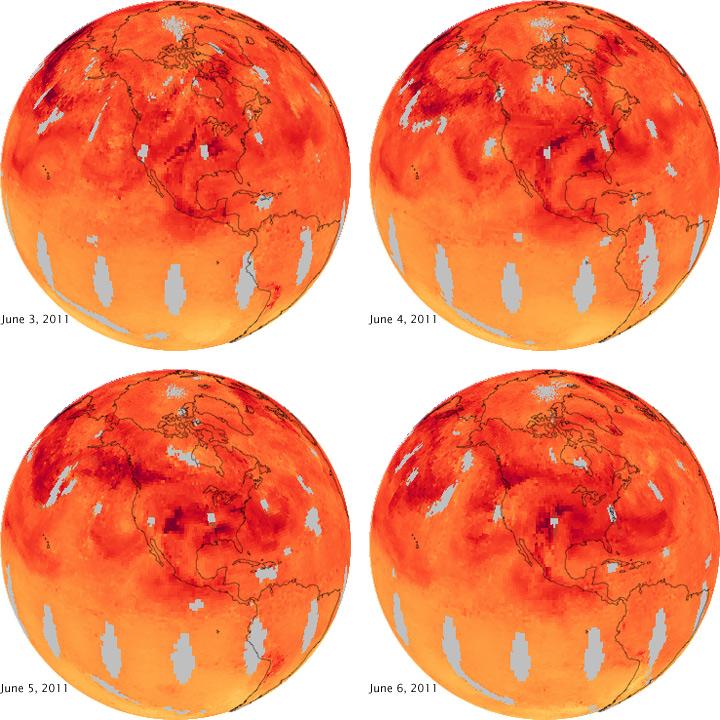
The smoke that is clouding skies in much of the Midwest contains a mix of gases and fine particles. One of the gases released when a fire burns is carbon monoxide, a colorless, odorless gas that damages human health by limiting the flow of oxygen through the body. It is also a key ingredient in the production of harmful ground-level ozone and urban haze.
On June 3, carbon monoxide flows northeast directly from eastern Arizona. By the next day, concentrations are higher north of the fire.
While much of the carbon monoxide shown here is from the Wallow Fire, some may also be from urban pollution. In the United States, vehicles and other gasoline-powered equipment generate the bulk of carbon monoxide pollution.
Breaking space news, the latest updates on rocket launches, skywatching events and more!
Wallow North and Horseshoe Two Fires
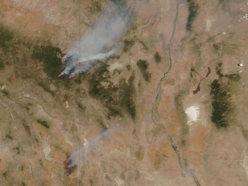
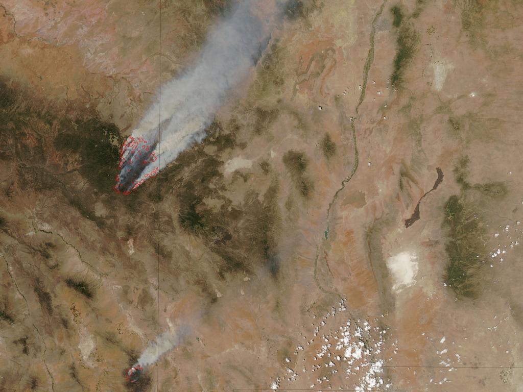
The blaze from Wallow North, one of Arizona’s most potent fires, grows at an alarmingly fast rate. Likewise an end to the Horseshoe Two fires seems nowhere in sight. U.S. Forest Service officials rank the Wallow North fire, which has left 600 square miles of pine forest blackened, as Arizona’s second-largest forest fire on record, according to Reuters.
Both fires are continuing to produce thick clouds of smoke, as seen in this image.
Fire officials said they are bringing in a Boeing 747 supertankers to assist with the fires and spread fire retardant chemicals, reported the KPHO news service on June 8.
NASA's MISR Instrument Sees Wildfires Burn Out of Control
This image from NASA’s Multi-angle Imaging SpectroRadiometer (MISR) instrument on the Terra spacecraft show the Wallow and Horseshoe 2 Fires currently burning in Arizona. The data were acquired mid-morning (local time) on June 7, 2011. As of June 8, the large Wallow fire in the White Mountains has burned more than 389,000 acres (more than 608 square miles, or 1,574 square kilometers) and is currently the second largest fire in Arizona history. More than 2,000 people are working to contain the fire, which is being driven by high winds and low humidity. The smaller Horseshoe 2 Fire in the Chiricahua Mountains has burned more than 106,000 acres (166 square miles, or more than 429 square kilometers) in southeastern Arizona.
NASA's CALIPSO Satellite Sees Wallow Fire Plume 3 Miles High
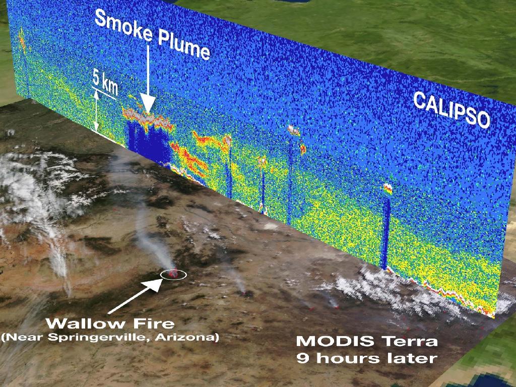
A CALIPSO vertical profile from space shows the smoke plume on June 3, 2011 from the wildfires currently raging in Arizona. It is overlaid on an image captured by the Moderate Resolution Imaging Spectroradiometer (MODIS) instrument on the Terra satellite nine hours later. The data shows that the Wallow Fire smoke plume reached heights of 5 kilometers ( 3 miles) high.
Landsat 7 Sees Smoke from Raging Arizona Wallow Fire
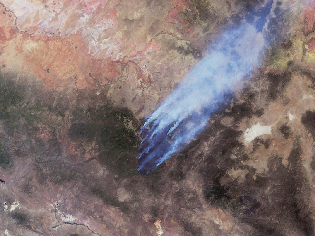
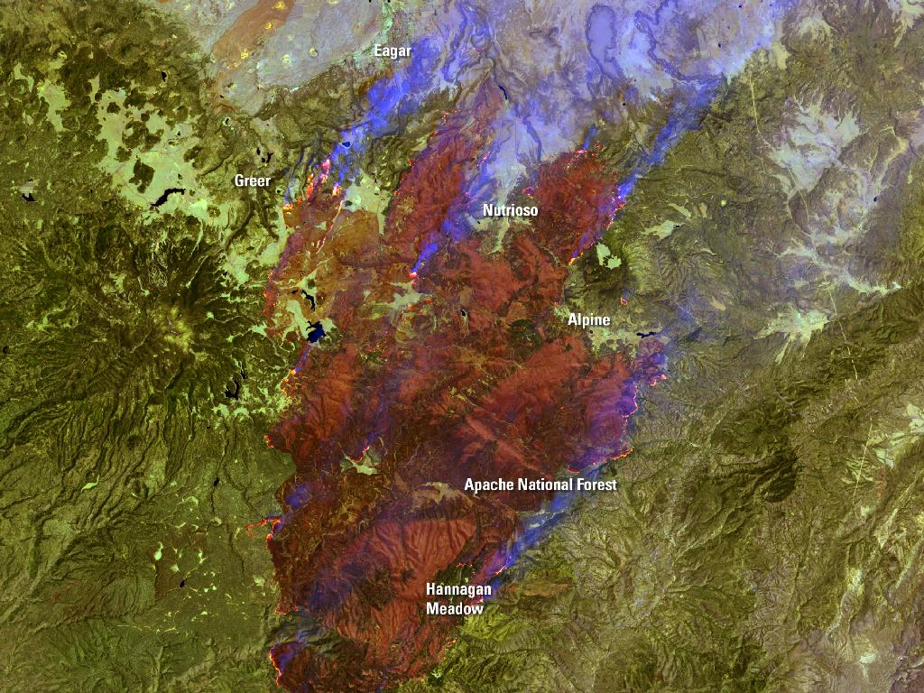
Burning in the mountains of eastern Arizona near the border with New Mexico, the Wallow Fire has become the second largest fire in Arizona history. Starting on May 29, winds and hot, dry conditions helped the fire grow quickly, burning approximately 389,000 acres when the Landsat 7 image above was acquired. The dense plume of smoke pouring north from the massive fire affected air quality as far north as Wyoming and as far east as Georgia.

Space.com is the premier source of space exploration, innovation and astronomy news, chronicling (and celebrating) humanity's ongoing expansion across the final frontier. Originally founded in 1999, Space.com is, and always has been, the passion of writers and editors who are space fans and also trained journalists. Our current news team consists of Editor-in-Chief Tariq Malik; Editor Hanneke Weitering, Senior Space Writer Mike Wall; Senior Writer Meghan Bartels; Senior Writer Chelsea Gohd, Senior Writer Tereza Pultarova and Staff Writer Alexander Cox, focusing on e-commerce. Senior Producer Steve Spaleta oversees our space videos, with Diana Whitcroft as our Social Media Editor.
