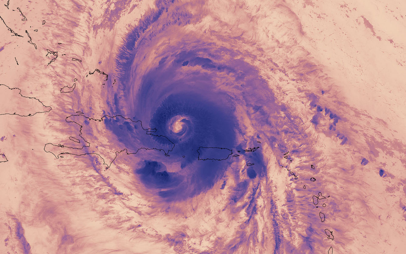
Puerto Rico from Space: NASA Videos Show Aftermath of Hurricane Maria
Fourteen months after Hurricane Maria wreaked havoc on Puerto Rico, causing widespread flooding and power outages, NASA researchers are still studying the storm's long-term effects on the island's natural environment as well as its human population.
Using satellite data and imagery, researchers have mapped the ongoing power outages across the island. Their data show that long-term blackouts have disproportionately affected people in rural areas.
Meanwhile, another team of researchers studying the hurricane's effects on Puerto Rico's forests found that about half of the tall trees that make up the forests' canopies were lost or damaged — and that could spell problems for the soil below, NASA officials said in a statement. [In Photos: Hurricane Maria Seen from Space]
Blackouts by night
Satellite images taken of Puerto Rico by night before Hurricane Maria show an island aglow with artificial light from cities and smaller communities. After Hurricane Maria ravaged the island as a Category 4 storm, a blackout left the island practically invisible from space at night, with the exception of a small area around San Juan.
Six months later, power was restored to much of the island, and about 16 percent of the U.S. territory remained without power. But that didn't last long. Puerto Rico's power grid collapsed once again in April 2018, causing an islandwide blackout.
Scientists at NASA's Goddard Space Flight Center in Greenbelt, Maryland, have been monitoring Puerto Rico's electricity grid since the hurricane by creating maps of the island's lights using imagery from the Suomi NPP satellite, a joint operation between NASA and the National Oceanic and Atmospheric Administration (NOAA). The satellite is best known for its gorgeous "Black Marble" images of Earth by night.
By combining images from Suomi NPP with Landsat images and OpenStreetMap data, the researchers "developed neighborhood-scale maps of lighting in communities across Puerto Rico," NASA officials said.
Breaking space news, the latest updates on rocket launches, skywatching events and more!
The study found that Puerto Rico's power outages disproportionately affected rural communities, where 41 percent of neighborhoods underwent "prolonged periods of outage," while only 29 percent of urban areas suffered from lengthy power outages, NASA officials said. "The difference between urban and rural recovery rates is in part because of the centralized setup of Puerto Rico's energy grid that directs all power to prioritized locations rather than based on proximity to the nearest power plant," which is why areas with lower population densities suffered the worst of the blackouts, NASA officials said.
"It's not just the electricity being lost," Miguel Román, a research scientist at Goddard, said in the statement. "Storm damage to roads, high-voltage power lines and bridges resulted in cascading failures across multiple sectors, making many areas inaccessible to recovery efforts. So people lost access to other basic services like running water, sanitation, and food for extended time periods."
Román and his colleagues hope to build upon this method to help disaster relief efforts in the future by combining this satellite data with maps that show up-to-date information on the status of local infrastructure, including roads, bridges, dams and access to clean water "so that when the lights are out, disaster responders can cross-reference energy data with other infrastructure bottlenecks" and see what problems need to be solved first, so that at-risk communities could be identified and resources could be allocated efficiently.
Forests get a "haircut"
While one team of Goddard scientists has been investigating the effects Hurricane Maria had on the human communities of Puerto Rico, another team has been using satellite images to see how the island's fauna is recovering from the catastrophic storm.
For up to six months before Hurricane Maria hit, NASA researchers had already been surveying Puerto Rico's rain forests by plane using an instrument called Goddard's Lidar, Hyperspectral, and Thermal (G-LiHT) airborne imager. This instrument uses laser pulses to create 3D, high-resolution maps of the rain forest. Using that data, scientists can determine not only the physical structure of the forest but also the distribution of the different plant species that live there.
After Hurricane Maria, Goddard scientists returned with the G-LiHT imager to see how the storm had affected the structure of Puerto Rico's rain forest — and the results are astonishing. "Comparing the before and after data, the team found that 40 to 60 percent of the tall trees that formed the canopy of the forest were damaged, either snapped in half, uprooted by strong winds or lost large branches," NASA officials said.
"Maria gave the island's forests a haircut," Goddard research scientist Doug Morton said in the statement. "The island lost so many large trees that the overall height of forests was shortened by one-third. We basically saw 60 years' worth of what we would otherwise consider natural treefall disturbances happen in one day."
The forest lost not only a considerable amount of height but also its ability to stabilize the earth below those trees. "Fallen trees that no longer stabilize soil on slopes with their roots as well as downed branches can contribute to landslides and debris flows, increased erosion, and poor water quality in streams and rivers where sediments build up," NASA officials said.
As the forest recovers from the damage, scientists will continue to monitor it from the air and from the ground, NASA officials said.
The findings of these studies were presented Monday (Dec. 10) at the American Geophysical Union meeting in Washington.
Email Hanneke Weitering at hweitering@space.com or follow her @hannekescience. Follow us on Twitter @Spacedotcom and on Facebook. Original article on Space.com.

Hanneke Weitering is a multimedia journalist in the Pacific Northwest reporting on the future of aviation at FutureFlight.aero and Aviation International News and was previously the Editor for Spaceflight and Astronomy news here at Space.com. As an editor with over 10 years of experience in science journalism she has previously written for Scholastic Classroom Magazines, MedPage Today and The Joint Institute for Computational Sciences at Oak Ridge National Laboratory. After studying physics at the University of Tennessee in her hometown of Knoxville, she earned her graduate degree in Science, Health and Environmental Reporting (SHERP) from New York University. Hanneke joined the Space.com team in 2016 as a staff writer and producer, covering topics including spaceflight and astronomy. She currently lives in Seattle, home of the Space Needle, with her cat and two snakes. In her spare time, Hanneke enjoys exploring the Rocky Mountains, basking in nature and looking for dark skies to gaze at the cosmos.

