In Photos: Hurricane Maria Seen from Space
Breaking space news, the latest updates on rocket launches, skywatching events and more!
You are now subscribed
Your newsletter sign-up was successful
Want to add more newsletters?

Delivered daily
Daily Newsletter
Breaking space news, the latest updates on rocket launches, skywatching events and more!

Once a month
Watch This Space
Sign up to our monthly entertainment newsletter to keep up with all our coverage of the latest sci-fi and space movies, tv shows, games and books.

Once a week
Night Sky This Week
Discover this week's must-see night sky events, moon phases, and stunning astrophotos. Sign up for our skywatching newsletter and explore the universe with us!

Twice a month
Strange New Words
Space.com's Sci-Fi Reader's Club. Read a sci-fi short story every month and join a virtual community of fellow science fiction fans!
Lots of Rain
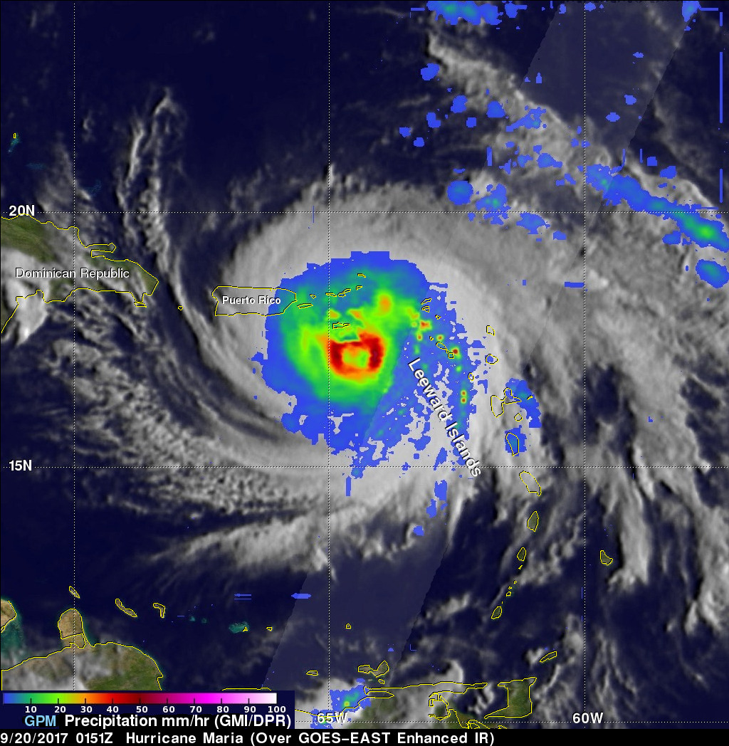
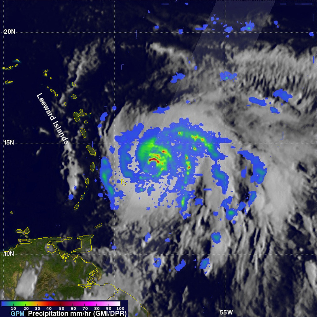
On Sept. 19, The GPM mission's radar measured extreme storms within Hurricane Maria with rain falling at over 5 inches per hour.
Warnings
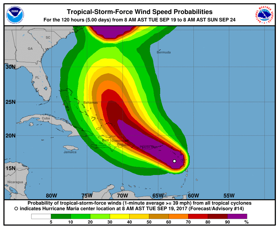
On Sept. 19, the NOAA issued a tropical-storm-force wind advisory that would remain in effect through Sept. 24.
Another Season
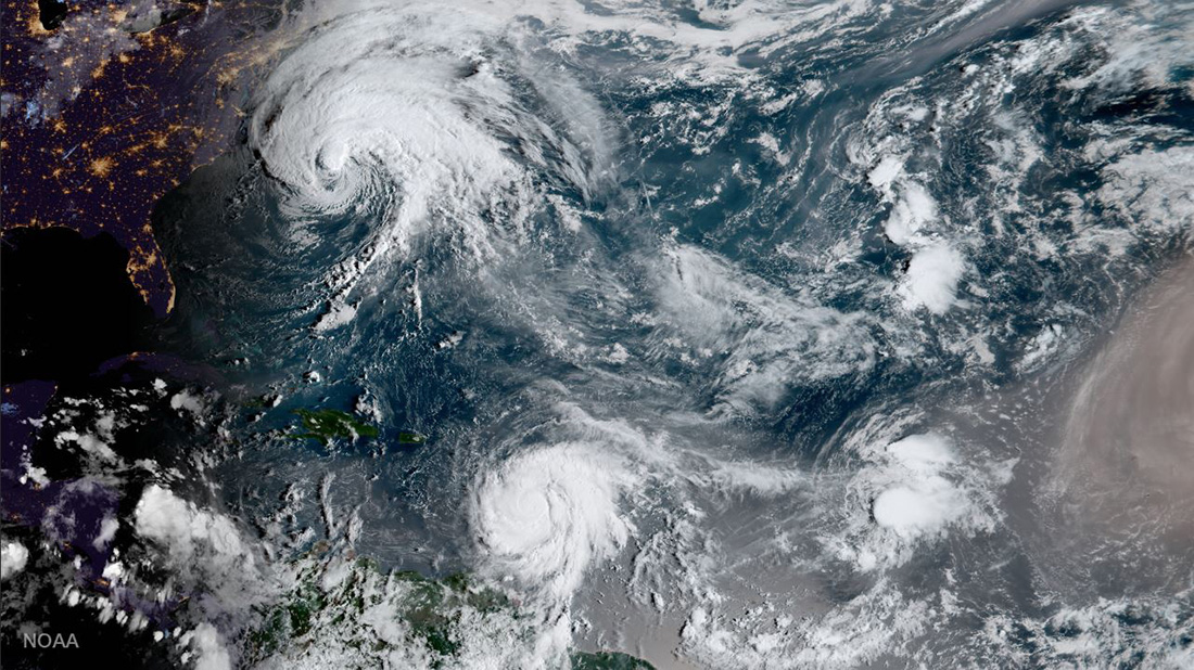
NOAA's GOES-16 captured this geocolor image of Hurricanes Jose and Maria and Tropical Depression Lee simultaneously churning through the Atlantic Ocean on Sept. 18.
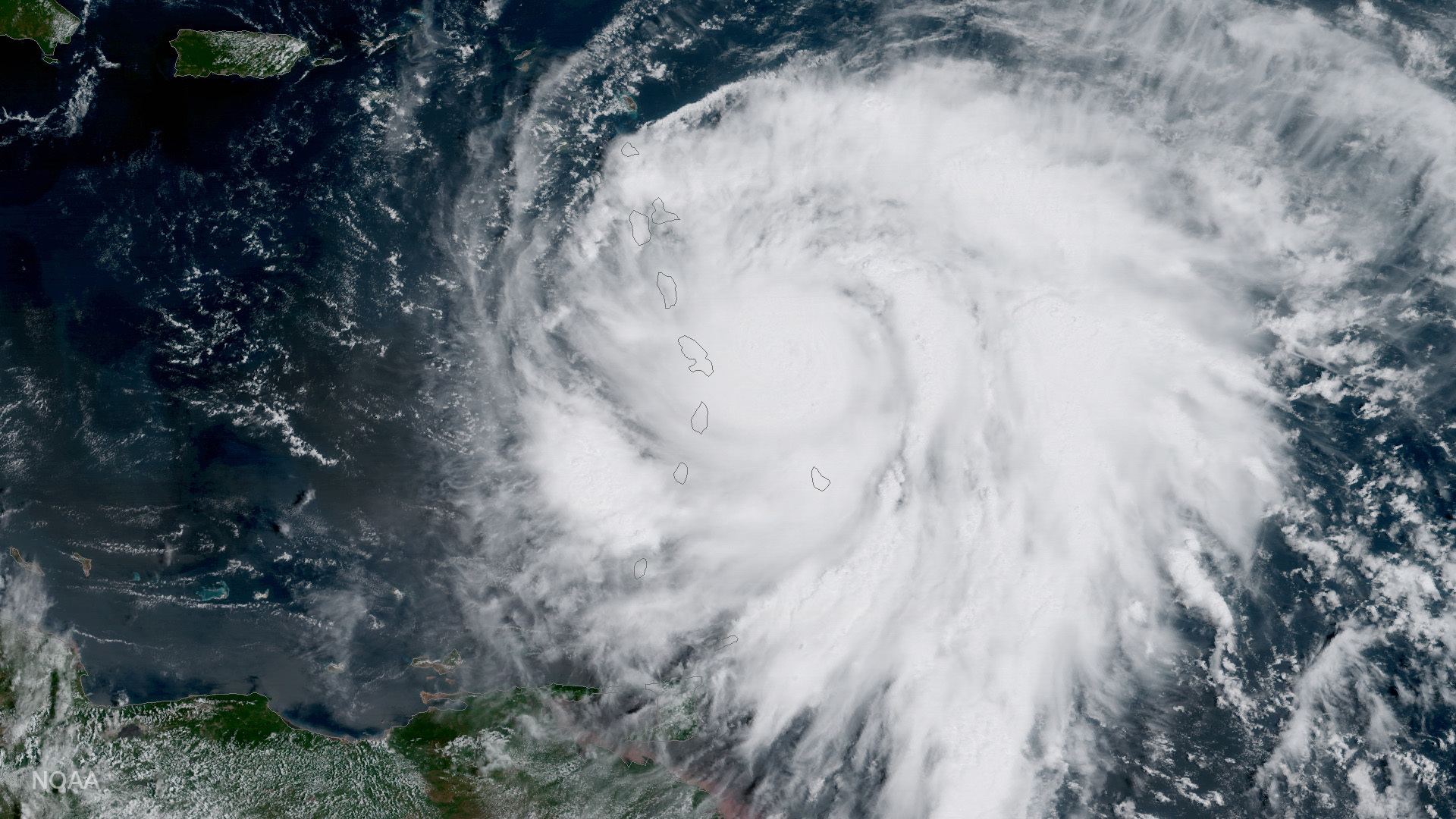
Maria Approaches the Caribbean
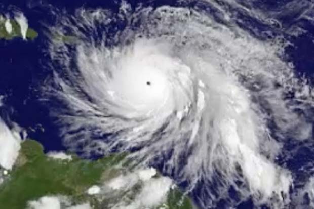
This image of Hurricane Maria was taken by NOAA's GOES East satellite on Sept. 18 at 10:45 a.m. EDT (1445 GMT) as it strengthened to a Category 3 hurricane just east of the Leeward Islands. Hurricane Maria made landfall on the Caribbean island of Dominica as a Category 5 storm later that day at 9:15 p.m. EDT (0115 GMT on Sept. 19).
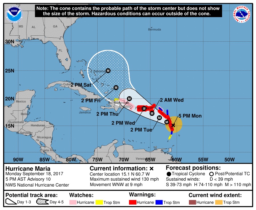
Maria's Projected Path
This graphic shows areas affected by Hurricane Maria, and the expected dates and times when the storm will arrive at those locations. The NOAA released this forecast on Sept. 18 at 5 p.m. EDT (2100 GMT).
Stormy Seas
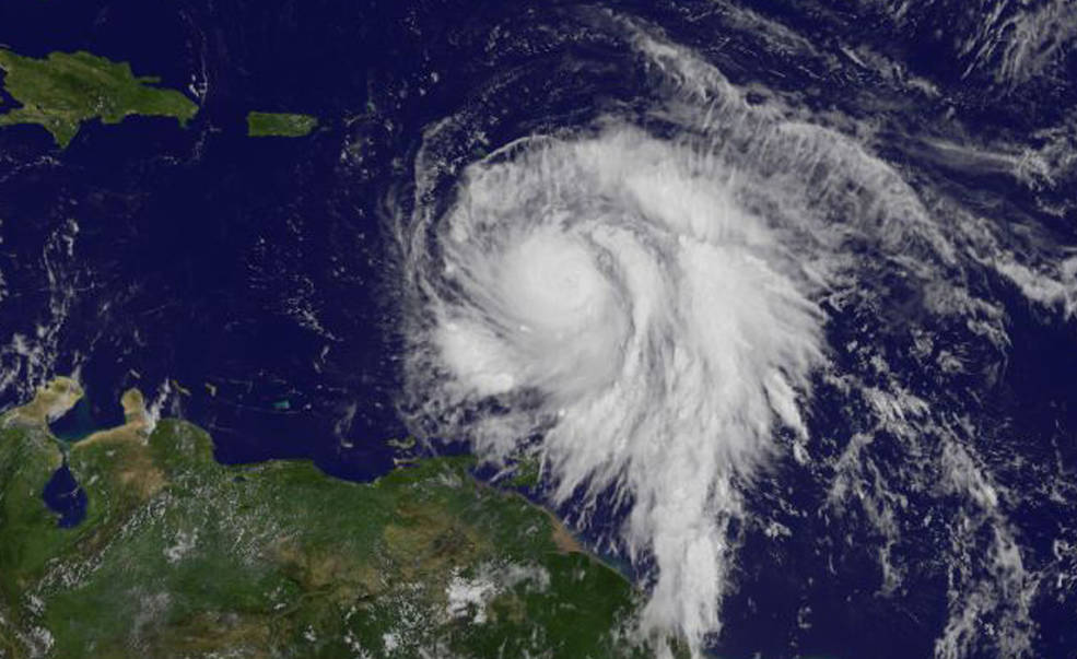
At a Category 1 storm, Hurricane Maria trekked across the Caribbean Sea toward the Leeward Islands in this GOES satellite image taken on Sept. 18.
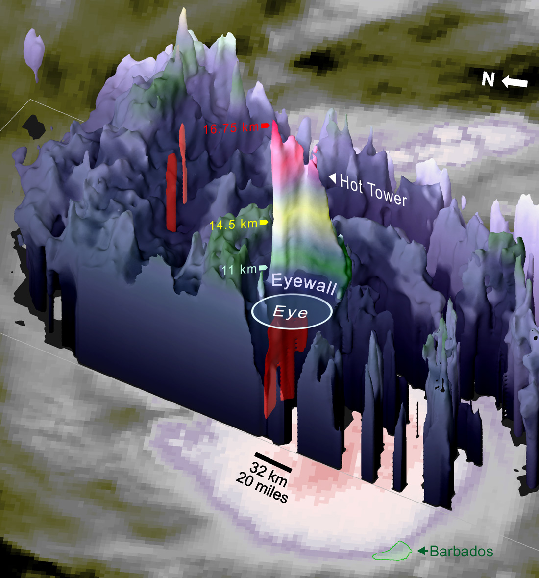
Impressive Height
On Sept. 18, NASA's Global Precipitation Measurement (GPM) satellite measured Hurricane Maria's cell at an imposing 10.41 miles (16.75 kilometers) altitude, stretching into the lower stratosphere.
Breaking space news, the latest updates on rocket launches, skywatching events and more!
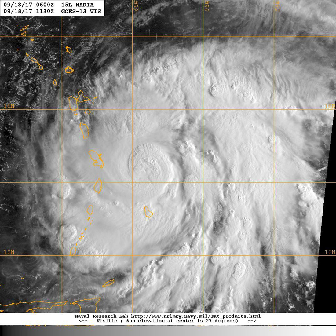
A View from GOES-13
Hurricane Maria is seen by NOAA's GOES-13 satellite (also known as GOES East) as the storm was located about 60 miles east of Martinique and moving toward the west-northwest near 10 mph on Sept. 18 at 11 a.m. EDT. At the time, Maria was a Category 3 hurricane. It later strengthened to a Category 5.
Gaining Strength
NASA's GOES-East satellite captured this view of Hurricane Maria on Sept. 18 as the Category 3 storm quickly evolved into a Category 5.
Dropping the Rain
Using the Global Precipitation Measurement (GPM) core satellite, experts found that Hurricane Maria contained falling rain at the rate of over 6 inches (15 centimeters) per hour. The thunderstorms inside Maria measure to more than a towering 9 miles high. The GPM satellite captured this view on Sept. 17 at 10:01 p.m. EDT (0201 GMT on Sept. 18).

Christine Lunsford joined the Space.com team in 2010 as a freelance producer and later became a contributing writer, covering astrophotography images, astronomy photos and amazing space galleries and more. During her more than 10 years with Space.com, oversaw the site's monthly skywatching updates and produced overnight features and stories on the latest space discoveries. She enjoys learning about subjects of all kinds.
