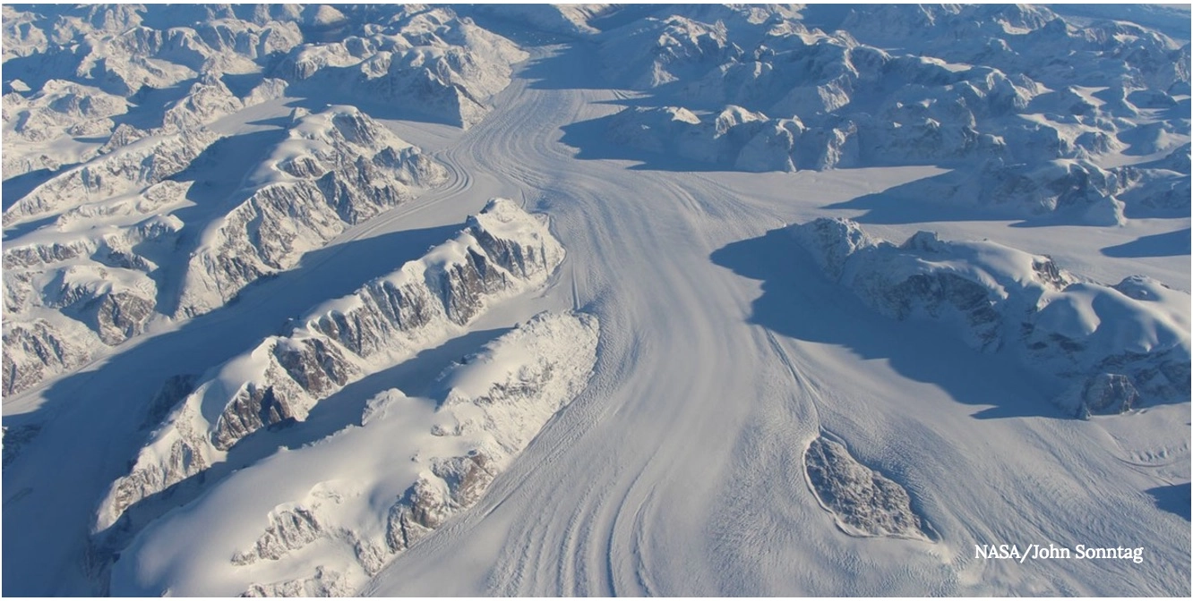
Scientists just got a new tool in the quest to predict if, how much, and when sea levels will rise on our planet in the future. The Global Land Ice Velocity Extraction project (GoLIVE) created a software tool that crunches both historical satellite images and current high-resolution pictures taken by the Landsat 8 satellite, which captures pictures of Earth's entire surface every 16 days, to give scientists an unprecedented and detailed image of how glaciers move.
The NASA-funded project — a collaboration between scientists from the University of Colorado, the University of Alaska, and NASA's Jet Propulsion Laboratory (JPL) in Pasadena, Calif. — is able to analyze both Landsat 8 images and historical satellite images to identify the subtle patterns in the surface of the ice and how they have changed over time. That data allows them to create computer models to predict what those ice flows will do in the future.
"Sea level rise is two things," said Dr. Alex S. Gardner, a JPL research scientist working on the project. "It is the ocean warming, because warm water takes up more volume than cold water. And it is ice from the continents that ends up in the ocean. If you want to know what sea level rise will be in the future, you have to know how much ice will go into the ocean. Once you answer that question, you know how much sea level will rise."
In this effort, having high-quality images from the Landsat 8 satellite is important. But it isn't the key that unlocks the answer. "The satellite is fantastic," says Gardner. "But it was never designed to map glacial flow. The most important thing about this mission is continuity."
Earlier satellites also collected images of the glacial ice. But those showed the ice as white, without the detail of the Landsat 8. "But with the Landsat record we get a very long — in many places 30 years — historical record of ice flow," says Gardner.
But much of the data from both sources went untapped because it required too much processing power to access. Technology has advanced to the point where it is possible for this team of scientists to mine that data. "So we can now see how ice flow is changing with time. And that is one of the most important variables to understand when predicting future changes."
This effort, led by a team that specializes in studying ancient ice, may seem to the uninitiated as worthy but purely academic. But the work is crucial especially as climate scientists fear that funding will be pulled in an incoming Trump administration. The project also has enormous financial implications.
"This has pragmatic impact on shoreline infrastructure and for urban development," says Gardner. "For example, deciding to build a one-meter or two-meter high sea wall has huge financial implications. We are trying to estimate the rise of sea level so we can plan for the future."
WATCH: What Happens If All The World's Ice Melts?
Originally published on Seeker.