


Satellite Sees Fog Roll Into San Francisco
If any type of weather is synonymous with San Francisco, it's probably fog.
It rolls in off the Pacific Ocean and envelops the city, swathing famous landmarks like the Golden Gate Bridge.
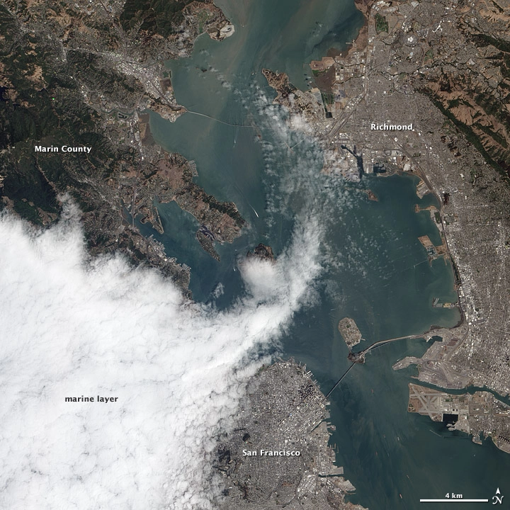
The Advanced Land Imager (ALI) on NASA's Earth Observing-1 (EO-1) satellite caught an overhead view of fog rolling in to the city on Aug. 16.
The fog is part of the marine layer, a mass of cool, dense air from the sea that was sandwiched beneath a layer of warmer air. Fog is often present in the lower part of the marine layer, whereas wispy stratus clouds form in the upper part, according to a NASA release. Fog itself is essentially low-lying stratus clouds that make contact with the ground.
The marine layer makes frequent incursions into the city in the summer months due to a particular interaction of ocean currents and air patterns. The fog intrusions happen when westerly winds push the cool sea air inland to replace the warm air rising off of California's Central Valley, according to NASA.
Here's how it starts: During the summer, a high-pressure weather pattern called the Pacific High moves north and strengthens. This migration causes a shift in wind patterns that in turn affects the California Current, a major ocean current that flows from British Columbia south along the Pacific coast, NASA explained.
The waters of the current get pushed offshore, which allows deeper, colder waters to upwell. When the sea breeze blows over this cooler water, the water vapor contained in the air condenses out into fog.
As often happens, the fog completely enveloped the Golden Gate Bridge in this image. (The bridge visible in the lower part of the image is the Bay Bridge; the Richmond-San Rafael Bridge lies to the north.)
This story was provided by OurAmazingPlanet, a sister site to SPACE.com.