Photos: NASA's Mars Rover Curiosity on Red Planet (Week 2)
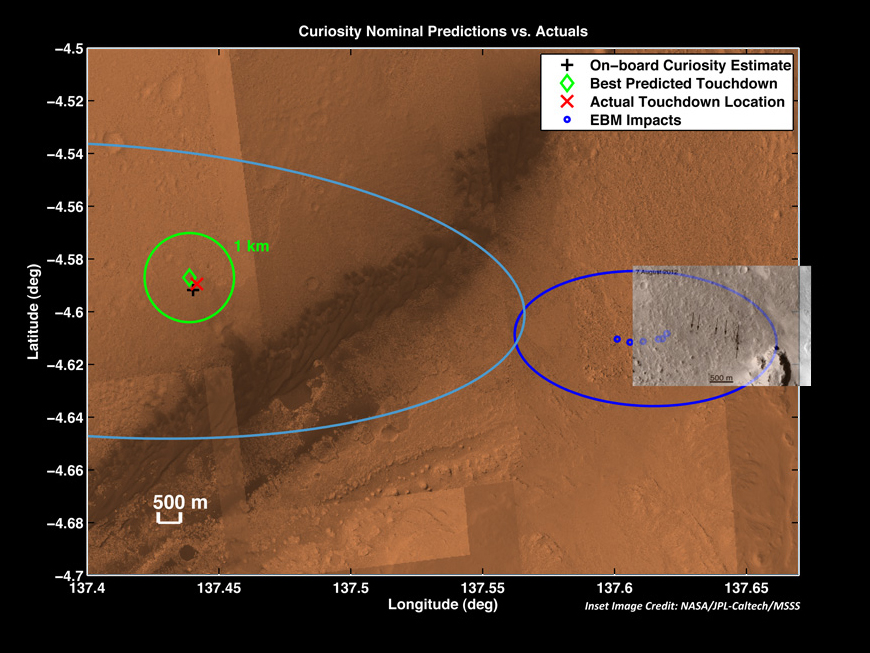
Curiosity Mars Rover's Actual and Predicted Landing Sites
The red X marks where NASA's Curiosity's Mars rover landed on Aug. 5, 2012 — about 1.5 miles east of the spot it was targeting. The dark blue ellipse at right shows the predicted landing sites for Curiosity's tungsten ballast (blue dots) and their actual impact spots (arrows). The dark streak cutting diagonally across the image's center is a stretch of sand dunes.
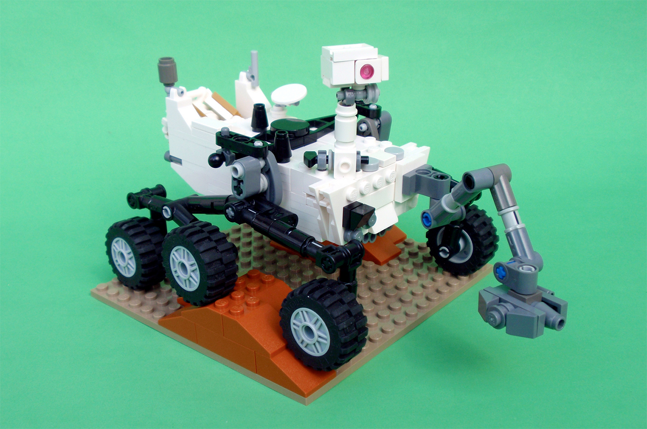
LEGO Mars Rover Curiosity
Mechanical engineer Stephen Pakbaz's LEGO version of NASA's Mars Science Laboratory rover, Curiosity — now with step-by-step instructions.
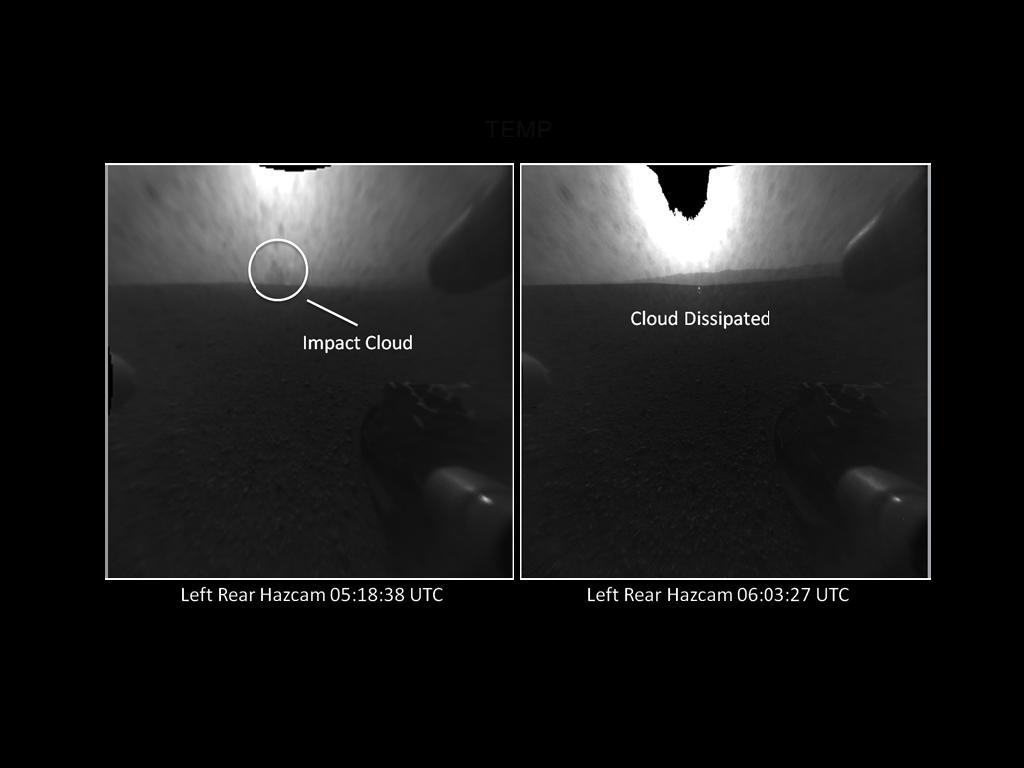
Mars Rover Curiosity Sky Crane Crash
The distant blob seen in the view on left, taken by a Hazard-Avoidance camera on NASA's Curiosity rover is likely the impact cloud from the rover's descent stage after landing on Aug. 5 PDT, 2012. The cloud disappears in later photos.
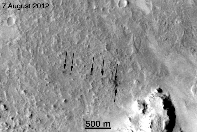
Craters from Curiosity's Ballast Ejection
This image from NASA's Mars Reconnaissance Orbiter shows the six craters created by the ejection of tungsten slugs during the Curiosity Mars rover's landing on Aug. 5, 2012.
Curiosity's Landing-Zone Quadrangles on mars
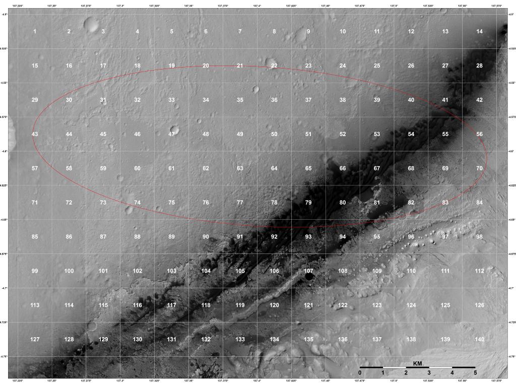
Before Curiosity landed on Mars, scientists divided its potential landing zone into 151 "quadrangles" measuring about 1 mile on a side. Curiosity landed on quadrangle 51, which is now known as Yellowknife.
Mars Curiosity Rover with Rocks
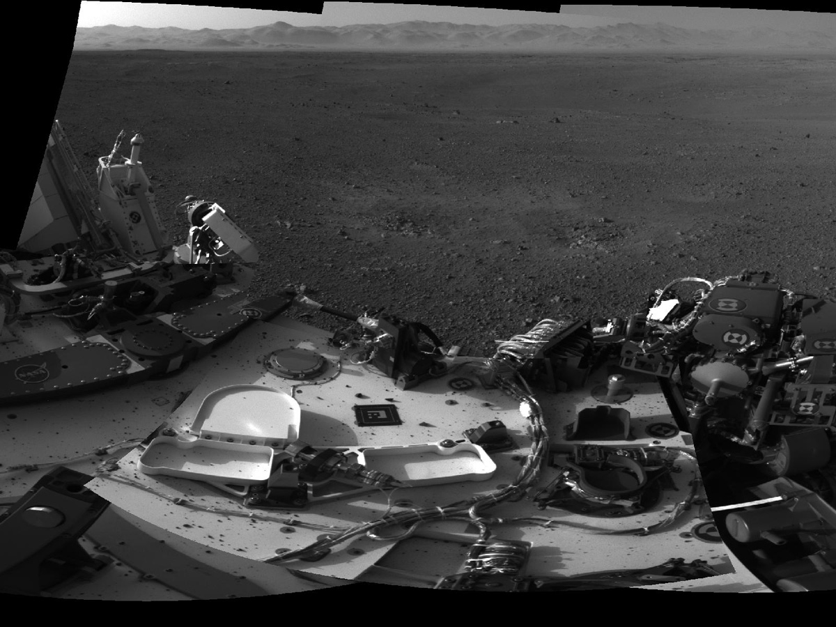
This close-up look at the Mars rover Curiosity's deck shows small Martian rocks on top of the rover. The rocks were kicked up by Curiosity's sky crane rockets, but pose no concern for the rover. Image taken on Sol 3 (Aug. 8-9, 2012).
Clear Views on Mars
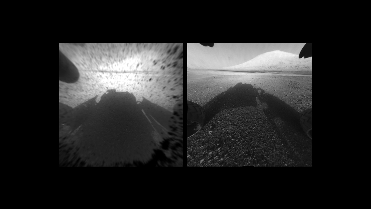
This image comparison shows a view of Mars through a Hazard-Avoidance camera on NASA's Curiosity rover before and after the clear dust cover was removed. Both images were taken by a camera at the front of the rover. Mount Sharp, the mission's ultimate destination, looms ahead. The view on the left, with the dust cover on, is one quarter of full resolution, while the view on the right is full resolution. Composite image released August 7, 2012.
Breaking space news, the latest updates on rocket launches, skywatching events and more!
Curiosity's Martian Landscape Portrait in Context
This picture of the Martian landing site of NASA's Curiosity rover puts a color view obtained by the rover in the context of a computer simulation derived from images acquired from orbiting spacecraft. The view looks north, showing a distant ridge that is the north wall and rim of Gale Crater. The color image was obtained by Curiosity's Mars Hand Lens Imager (MAHLI) on Aug. 6 PDT (Aug. 7 UTC), the first Martian day after Curiosity's landing on Aug. 5 PDT (Aug. 6 UTC).
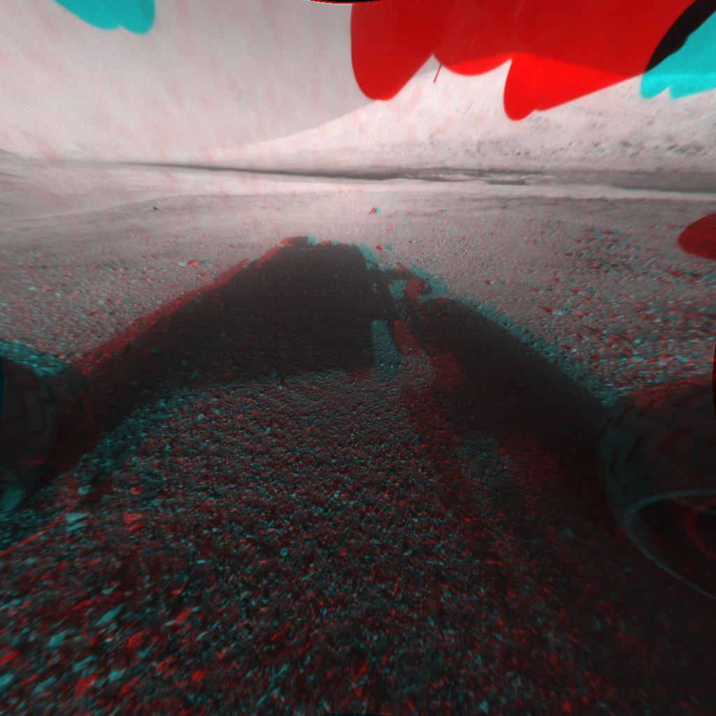
Curiosity 3-D Front View of Mars
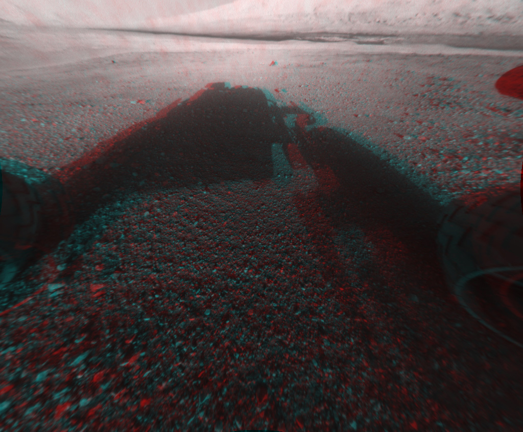
This image is a 3-D view in front of NASA's Curiosity rover, which landed on Mars on Aug. 5 PDT (Aug. 6 EDT). The anaglyph was made from a stereo pair of Hazard-Avoidance Cameras on the front of the rover. The image is cropped but part of Mount Sharp, a peak that is about 3.4 miles (5.5 kilometers) high, is still visible rising above the terrain.
3-D View of Mars from the Front of Curiosity
This image is a 3-D view in front of NASA's Curiosity rover, which landed on Mars on Aug. 5 PDT (Aug. 6 EDT). The anaglyph was made from a stereo pair of Hazard-Avoidance Cameras on the front of the rover. Mount Sharp, a peak that is about 5.5 miles (3.4 miles) high, is visible rising above the terrain, though in one "eye" a box on the rover holding the drill bits obscures the view.

Space.com is the premier source of space exploration, innovation and astronomy news, chronicling (and celebrating) humanity's ongoing expansion across the final frontier. Originally founded in 1999, Space.com is, and always has been, the passion of writers and editors who are space fans and also trained journalists. Our current news team consists of Editor-in-Chief Tariq Malik; Editor Hanneke Weitering, Senior Space Writer Mike Wall; Senior Writer Meghan Bartels; Senior Writer Chelsea Gohd, Senior Writer Tereza Pultarova and Staff Writer Alexander Cox, focusing on e-commerce. Senior Producer Steve Spaleta oversees our space videos, with Diana Whitcroft as our Social Media Editor.
