Space Space
Sign in
  • View Profile
  • Sign out
RSS
  • Sign up to our newsletter Newsletter
    • Space Exploration
    • Astronomy
    • Stargazing
    • Launches & Spacecraft
    • Videos
    • The Moon
    • More
      • Subscribe to Our Newsletters
      • Live 4K Video from Space
      • Artemis
      • James Webb Space Telescope
      • Entertainment
      • Solar System
      • Technology
      • Search for Life
      • Get Space Magazines
      • About Us
      • Web Notifications
    Trending
    • A total lunar eclipse is coming!
    • Next Full Moon
    • Aurora Forecast
    • Live 4K Sen video from space!
    • Night sky tonight!
    • Space Calendar
    • Best Binoculars
    • Best Telescopes
    • Lego Star Wars deals
    • Best Drones
    • Solar System Planets
    • Best Star Projectors
    Recommended reading
    fire and smoke rolls through a green countryside as seen from space
    Satellites Satellites watch France's largest wildfire in 75 years burn an area larger than Paris
    A still image from a weather satellite showing the smoke from the Grand Canyon wildfire.
    Earth Satellite images track Grand Canyon wildfires burning across thousands of acres
    A plume of white smoke is seen over the green landscape of Earth from space
    Earth Is that wildfire smoke plume hazardous? New satellite tech can map smoke plumes in 3D for better air quality alerts at neighborhood scale
    image showing a large filament eruption and an inset image showing the large canyon left behind from the outburst.
    The Sun Colossal eruption carves 250,000-mile-long 'canyon of fire' into the sun (video)
    A series of purple and blue and orange shapes
    Earth New satellite constellation will scan the entire Earth every 20 minutes to find wildfires
    A green land mass with streaks of red and white clouds above it showing a volcano eruption of Mt. Etna
    Earth Mount Etna's terrifying eruption from orbit | Space photo of the day for June 4, 2025
    Dried and cracked mud is seen in a dried out area
    Climate Change Earth's continents are drying out at unprecedented rate, satellite data reveal
    1. Space Exploration
    2. Satellites

    California's Caldor Fire seen from space in harrowing satellite images (gallery)

    News
    By Christine Lunsford published 1 September 2021

    It's one of the biggest fires in California history.
    When you purchase through links on our site, we may earn an affiliate commission. Here’s how it works.

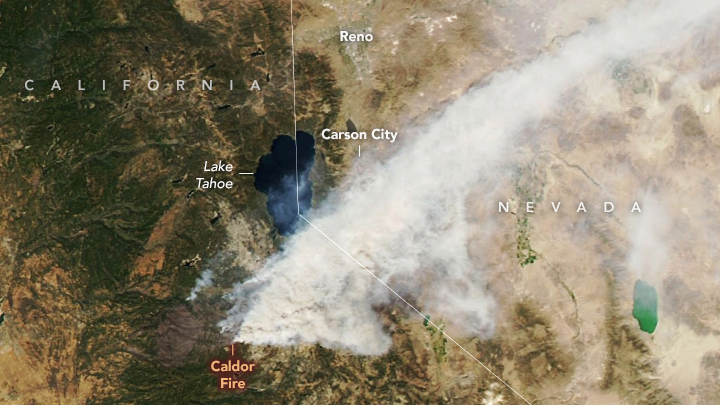
    Caldor Fire nears Lake Tahoe

    Caldor Fire nears Lake Tahoe

    The Caldor Fire, one of the largest in California's history, has been blazing in El Dorado County since Aug. 14, 2021. 

    It has since burned more than 200,000 acres of land and is now progressing toward the border of Nevada, near Lake Tahoe, according to the California Department of Forestry and Fire Protection. See satellite images of the growing fire in this Space.com gallery. 

    The image above, captured Aug. 30 by NASA's Aqua satellite, shows smoke from the Caldor Fire encroaching on the southern portion of Lake Tahoe. 

    Related: Record temperatures, fire clouds and drought ravage Earth in 2021
    Page 1 of 12
    Page 1 of 12
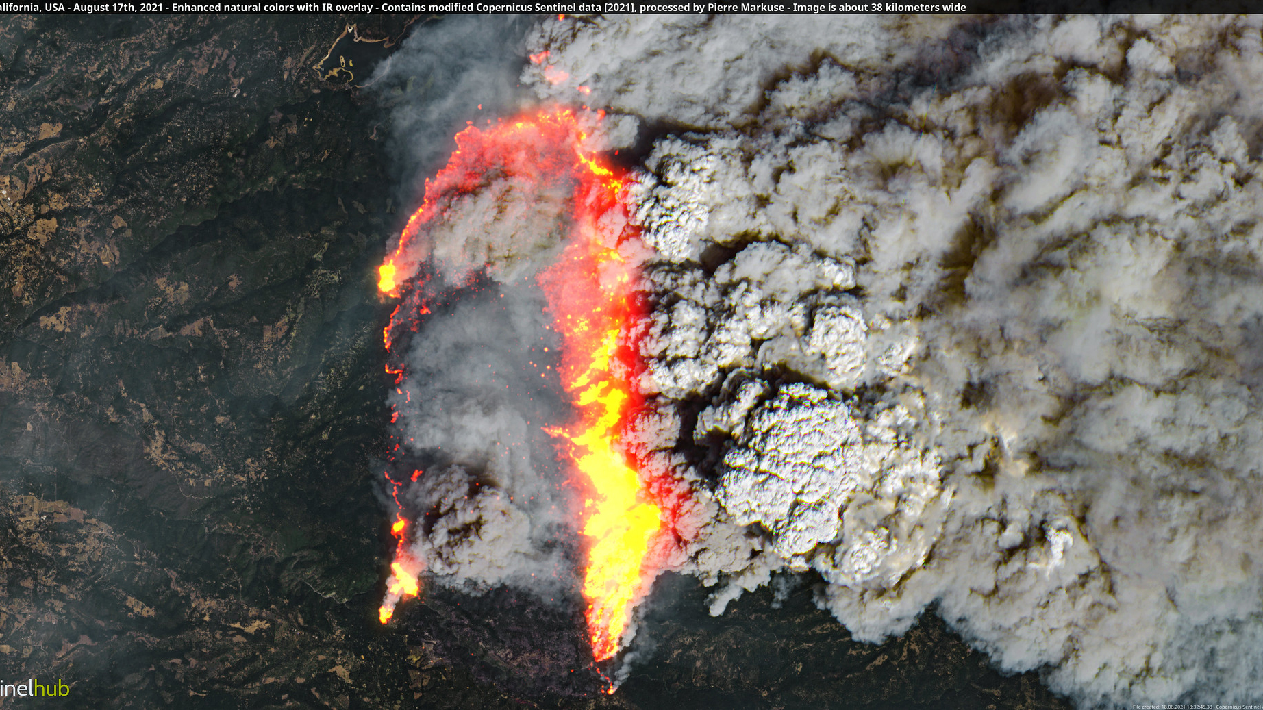
    Caldor Fire on Aug. 17

    Caldor Fire on Aug. 17

    An early view of the Caldor Fire, captured Aug. 17, shows the flames and smoke cutting across the dry California landscape. At the time, the fire was about 24 miles (38 kilometers) wide.

    Page 2 of 12
    Page 2 of 12
    Caldor Fire on Aug. 30

    Caldor Fire on Aug. 30

    NOAA's GOES 17 satellite captured this image of the raging Caldor Fire on Aug. 30, 2021. The Caldor Fire had scorched nearly 200,000 acres of forest and land as of Aug. 31, 2021. Residents of towns near South Lake Tahoe were evacuated as the blaze spread.

    Full story: Satellite tracks vicious Caldor Fire spread in California in time-lapse video
    Page 3 of 12
    Page 3 of 12
    The Dixie Fire is still burning, too.

    The Dixie Fire is still burning, too.

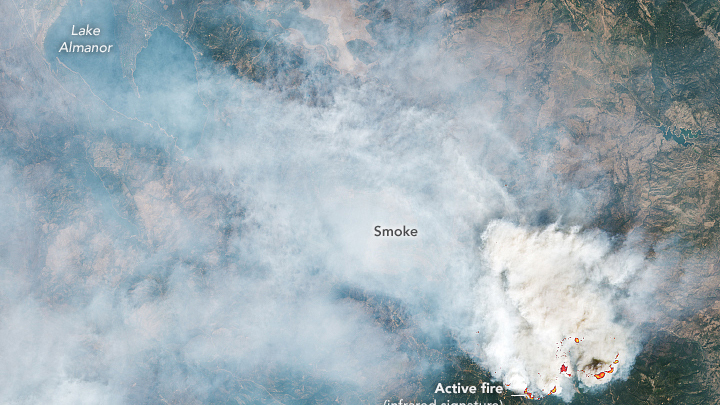
    Meanwhile, as the Caldor Fire has taken the spotlight, another fire is raging in Northern California. The second-largest Californian fire on record — the Dixie Fire —continues to burn has burned over 800,000 acres since July 13, 2021. This image from NASA's Landsat 8 satellite shows smoke from the Dixie Fire on Aug. 28, 2021, blanketing the region north of the Caldor Fire.

    Related: Satellite photos show Dixie Fire's devastation to California town in before-and-after views
    Page 4 of 12
    Page 4 of 12
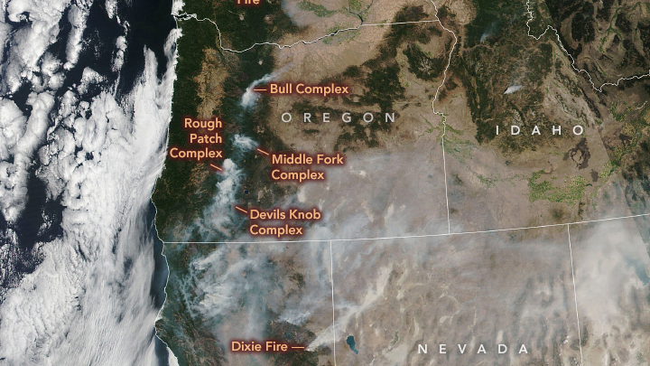
    More fires blaze to the north

    More fires blaze to the north

    Air quality across the western United States is posing risks to people due to the Caldor, Dixie and other fires. In this image, captured Aug. 29 by the NASA-NOAA Suomi NPP satellite, nine fires are seen burning across multiple western states.

    Related: North America is surrounded by 4 storms and wildfire smoke in this satellite view
    Page 5 of 12
    Page 5 of 12
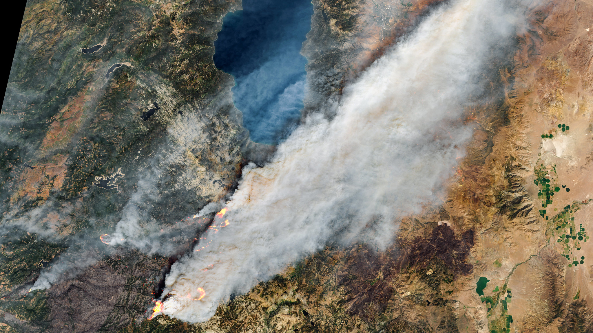
    Caldor Fire on Aug. 29

    Caldor Fire on Aug. 29

    South of Lake Tahoe in California, the Caldor Fire continues to burn, spewing smoke across the region. This image was processed by citizen scientist Pierre Markuse using data aquired by the European Space Agency's Copernicus Sentinel mission on Aug. 29, 2021. 
    Page 6 of 12
    Page 6 of 12
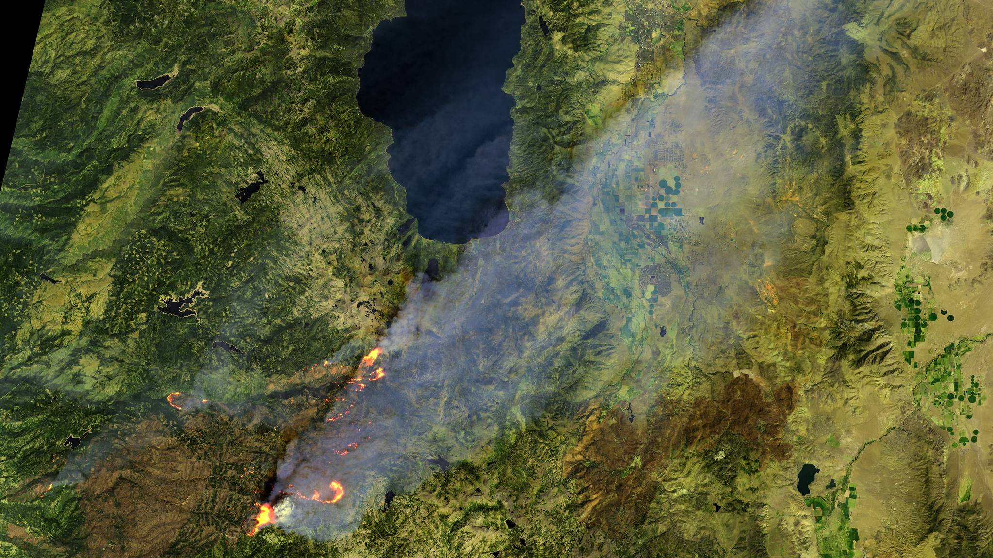
    Caldor Fire on Aug. 29

    Caldor Fire on Aug. 29

    In this satellite image aquired on Aug. 29, 2021, the Caldor Fire's smoke plume veils the region south of Lake Tahoe.
    Page 7 of 12
    Page 7 of 12
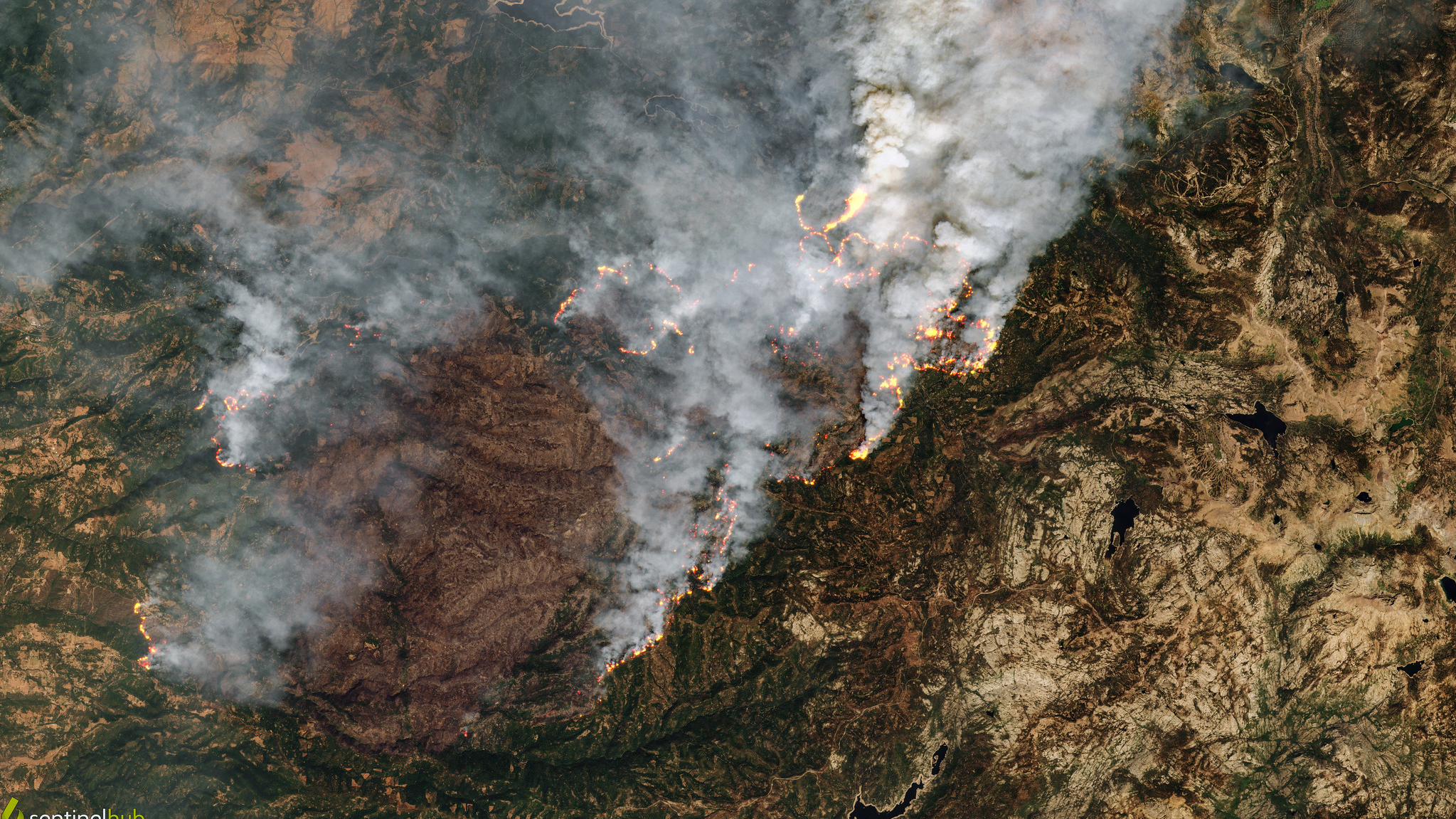
    Caldor Fire on Aug. 24

    Caldor Fire on Aug. 24

    On Aug. 24, 2021, the Caldor Fire continues to burn across the region south of Lake Tahoe. 
    Page 8 of 12
    Page 8 of 12
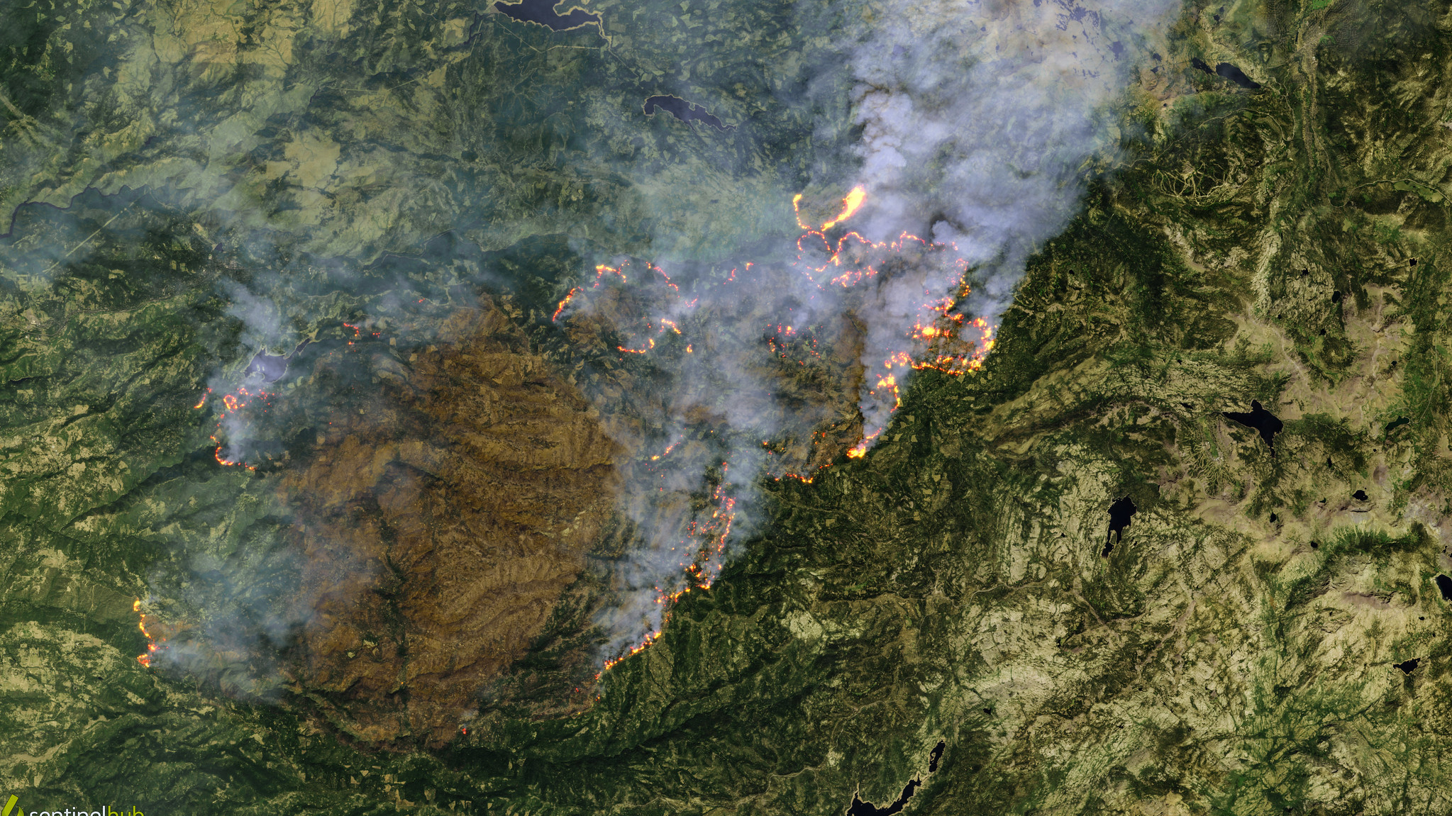
    Caldor Fire on Aug. 24

    Caldor Fire on Aug. 24

    The Caldor Fire, burning just south of Lake Tahoe, broke out on Aug. 14, 2021, and was only 20% contained as of Sept. 1. This image was processed by citizen scientist Pierre Markuse using data aquired by the European Space Agency's Copernicus Sentinel mission on Aug. 24, 2021.
    Page 9 of 12
    Page 9 of 12
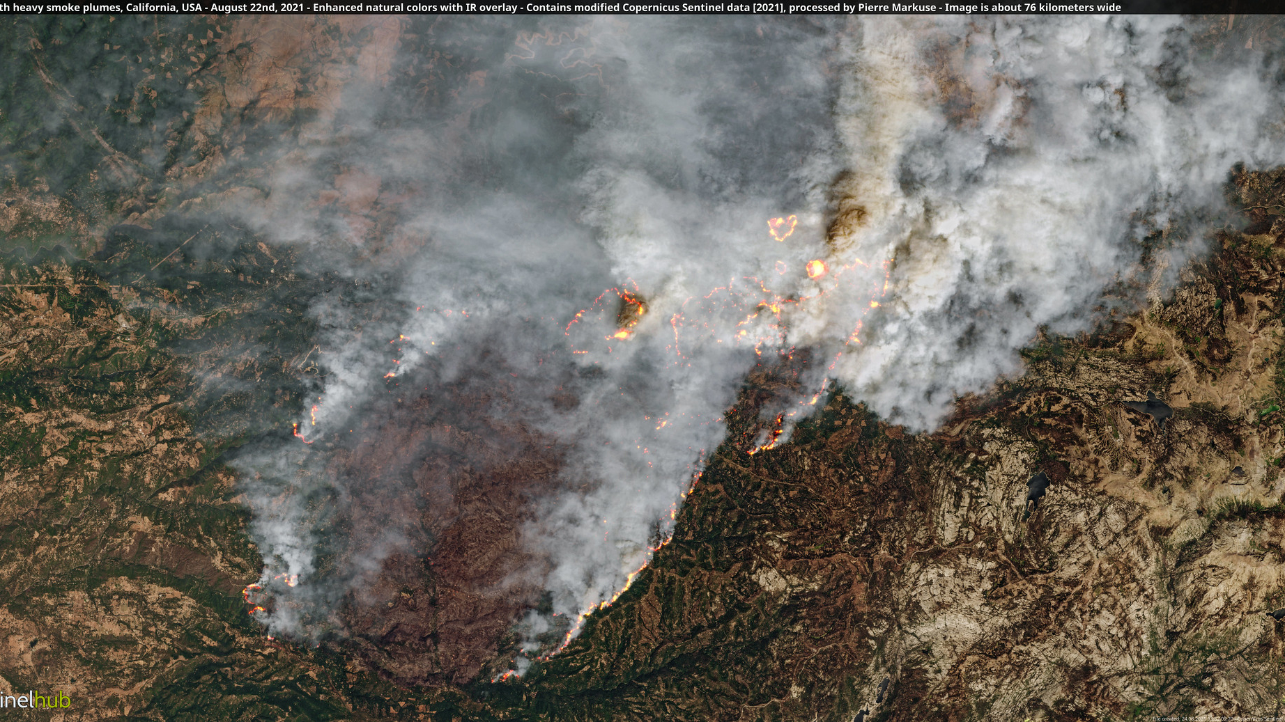
    Caldor Fire on Aug. 22

    Caldor Fire on Aug. 22

    As of Aug. 22, 2021, the Caldor Fire was blanketing the area with thick smoke as well as forcing residents in its path to flee.
    Page 10 of 12
    Page 10 of 12
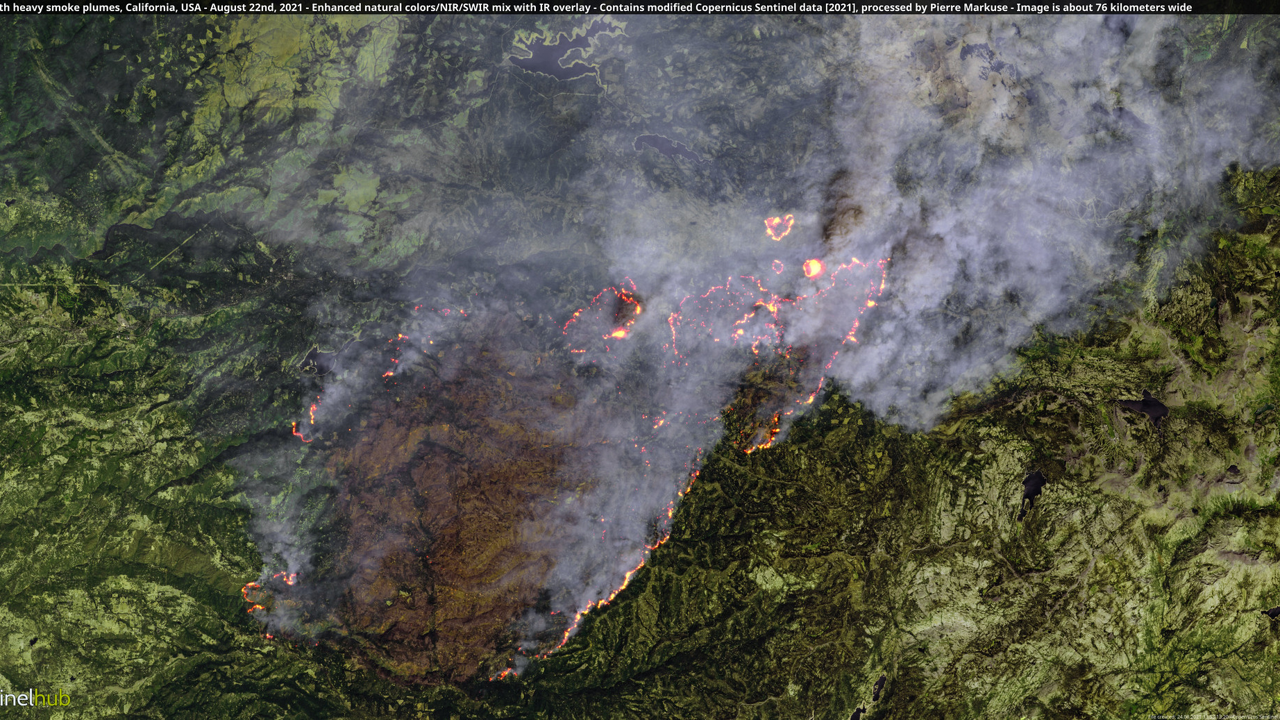
    Caldor Fire on Aug. 22

    Caldor Fire on Aug. 22

    Strong winds and low humidity pushed the Caldor Fire to spread over the ridge of the Sierra Nevada mountain range. Several more California counties had to be evacuated because of the spread.
    Page 11 of 12
    Page 11 of 12
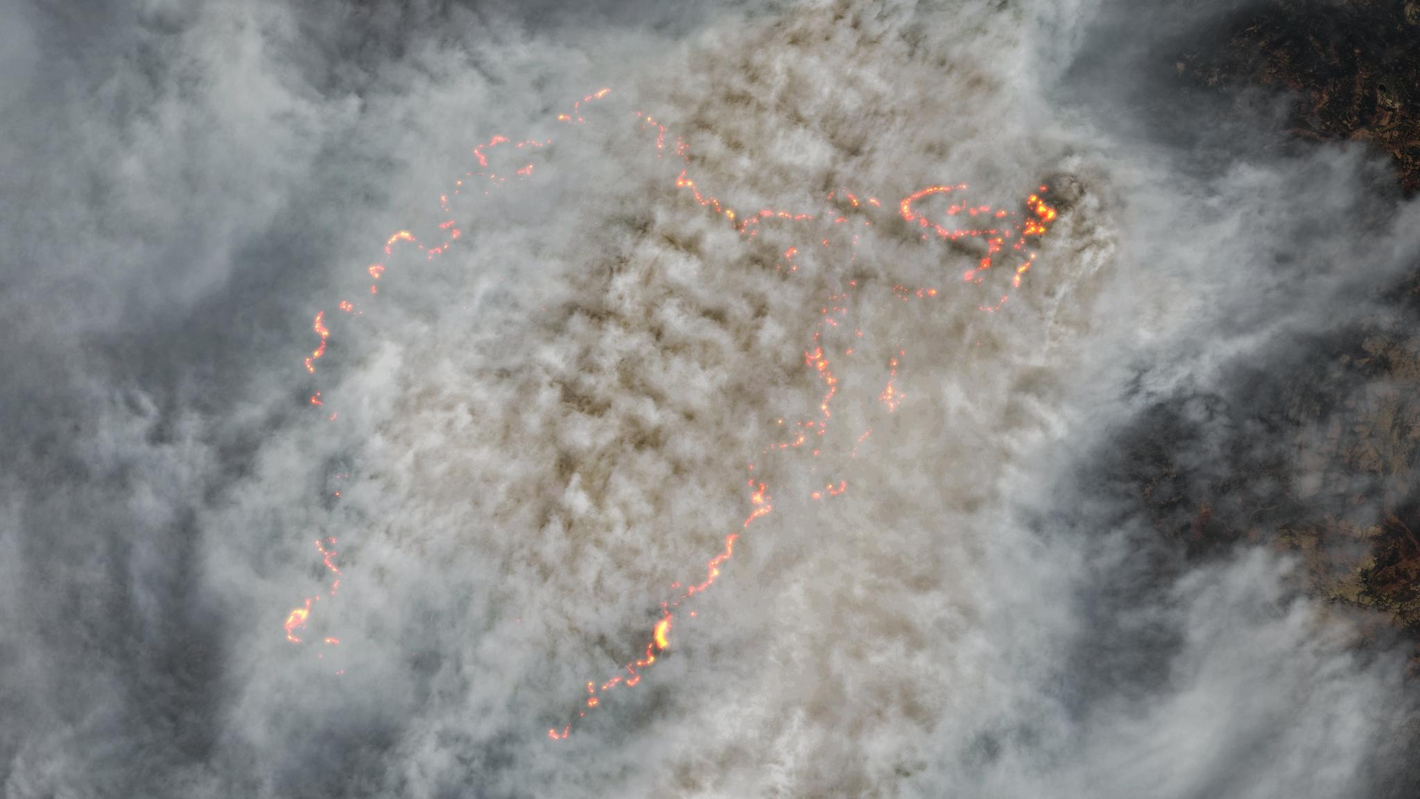
    Caldor Fire on Aug. 19

    Caldor Fire on Aug. 19

    Smoke and clouds above and around the Caldor Fire block views of the ground almost completely. This enormous fire began August 14, 2021 and as of August 31, has scorched just over 190,000 acres.

    Page 12 of 12
    Page 12 of 12
    Christine Lunsford
    Christine Lunsford
    Producer and Contributing Writer

    Christine Lunsford joined the Space.com team in 2010 as a freelance producer and later became a contributing writer, covering astrophotography images, astronomy photos and amazing space galleries and more. During her more than 10 years with Space.com, oversaw the site's monthly skywatching updates and produced overnight features and stories on the latest space discoveries. She enjoys learning about subjects of all kinds. 
    Read more
    fire and smoke rolls through a green countryside as seen from space
    Satellites watch France's largest wildfire in 75 years burn an area larger than Paris
    A still image from a weather satellite showing the smoke from the Grand Canyon wildfire.
    Satellite images track Grand Canyon wildfires burning across thousands of acres
    A plume of white smoke is seen over the green landscape of Earth from space
    Is that wildfire smoke plume hazardous? New satellite tech can map smoke plumes in 3D for better air quality alerts at neighborhood scale
    image showing a large filament eruption and an inset image showing the large canyon left behind from the outburst.
    Colossal eruption carves 250,000-mile-long 'canyon of fire' into the sun (video)
    A series of purple and blue and orange shapes
    New satellite constellation will scan the entire Earth every 20 minutes to find wildfires
    A green land mass with streaks of red and white clouds above it showing a volcano eruption of Mt. Etna
    Mount Etna's terrifying eruption from orbit | Space photo of the day for June 4, 2025
    Latest in Satellites
    fire and smoke rolls through a green countryside as seen from space
    Satellites watch France's largest wildfire in 75 years burn an area larger than Paris
    An illustration of two golden, square metal satellites with solar panels floating above Earth in space
    Space junk cleanup tech that could 'shepherd' debris into Earth's atmosphere gets US patent
    A wrapped up satellite sits on a metal cart next to two halves of a large cylindrical case, both also on carts in a cleanroom
    Powerful NISAR Earth-observing satellite loaded up for launch in India | Space photo of the day for July 30, 2025
    Sentinel-1 is the first in the family of Copernicus satellites launched by the European Space Agency. Two Sentinel-1 satellites have monitored the crack in the Larsen C ice shelf in the years leading up to the big split. They are also used to monitor Earth's environment, mapping sea ice and observing changes in land surfaces.
    'The ocean is no longer too big to watch': How AI and satellite data are helping rid Earth's seas of illegal fishing
    a man in a black military uniform sits at a desk behind microphones
    Space Force's Golden Dome chief says space-based missile interceptors are possible today. 'We have proven every element of the physics'
    three men in camouflage uniforms address a crowd of people also in camouflage uniforms outside a hangar on a concrete tarmac
    US Space Force practices 'orbital warfare' in largest-ever training event
    Latest in News
    SpaceX's Starship megarocket launches on its ninth-ever test flight on May 27, 2025.
    SpaceX aims to launch Starship Flight 10 test flight on Aug. 24
    An illustration of a black hole represented by a sphere with swirls of purple and brown light around it representing its accretion disk as it sits in the darkness of space
    X-ray telescope finds something unexpected with the 'heartbeat black hole'
    This Week In Space podcast: Episode 172 — Earth on Mars
    This Week In Space podcast: Episode 172 — Earth on Mars
    This Week In Space podcast: Episode 171 — What's an UNOOSA?
    This Week In Space podcast: Episode 171 — What's an UNOOSA?
    An artist's illustration of Blue Origin's New Glenn rocket in flight.
    Blue Origin's 2nd New Glenn rocket launch will fly twin NASA Mars probes to space on Sep. 29
    a man in a black short sleeve shirt and a blue headband floats inside a space station module cluttered with science equipment
    Astronaut trades meditation for starry sky views in orbit | On the International Space Station Aug. 11-15, 2025
    MORE FROM SPACE...
    1. SpaceX's Starship megarocket launches on its ninth-ever test flight on May 27, 2025.
      1
      SpaceX aims to launch Starship Flight 10 test flight on Aug. 24
    2. 2
      Blue Origin's 2nd New Glenn rocket launch will fly twin NASA Mars probes to space on Sep. 29
    3. 3
      NASA wants new spacecraft to reach 'difficult-to-reach orbits' around Earth and in deep space
    4. 4
      Russia to launch 75 mice, 1,000 fruit flies on Aug. 20 to study spaceflight effects
    5. 5
      X-ray telescope finds something unexpected with the 'heartbeat black hole'

    Space is part of Future US Inc, an international media group and leading digital publisher. Visit our corporate site.

    • About Us
    • Contact Future's experts
    • Terms and conditions
    • Privacy policy
    • Cookies policy
    • Accessibility Statement
    • Advertise with us
    • Web notifications
    • Careers

    © Future US, Inc. Full 7th Floor, 130 West 42nd Street, New York, NY 10036.

    Please login or signup to comment

    Please wait...