Clouds are such a regular part of daily life in most places on the planet that it's quite easy to forget about them — unless they're about to rain on you or ruin your perfectly planned astrophotography shot!
But clouds are crucially linked to temperature regulation on Earth, reflecting some of the sun's energy to keep us cool and trapping some to keep us warm, according to NASA.
Plus, clouds can be an indication of the weather that's on the way.
Related: Mars' clouds are strangely Earth-like, despite wildly different atmospheres
What are clouds?
Clouds are "a visible mass of particles of condensed vapor (such as water or ice) suspended in the atmosphere of a planet (such as the earth) or moon." According to Merriam-Webster
Earth's clouds are primarily made out of water, and you'll find them from the ground as fog all the way to altitudes up to 47 to 53 miles (76 to 85 km), where you'll find the rare noctilucent clouds. Most clouds, however, exist below 43,000 feet (13,100 m).
On Earth, clouds are responsible for rain, which is caused when water droplets in the clouds become too heavy, they fall back to the surface as precipitation such as rain or snow.
How do clouds form?

The formation of clouds requires the right combination of ingredients and conditions. There is always water in the Earth's atmosphere, so it's not just the presence of water that creates clouds.
Per NOAA, water molecules need something to attach to in order to condense — these objects are cloud condensation nuclei. Cloud condensation nuclei can be various things, from wildfire smoke to ocean spray to windblown dirt, but the key is they must be very small, about one micron (one one-thousandth of a millimeter) in size and hygroscopic (they attract water). Once water condenses on the nuclei, the overall cloud droplet is typically 100 times larger than the nuclei.
Temperature and dew point also play a role in cloud formation. The air must reach 100 percent relative humidity (when the temperature and dew point are the same) in order for condensation to occur. Because the air in the atmosphere is always moving, these criteria are always changing, which is why clouds can appear and disappear so quickly.
What are the different types of clouds?
The global standard for cloud classification is the World Meteorological Organization's International Cloud Atlas, which lists 10 main types of clouds.
Sometimes you'll hear of the four main types of clouds, and that's referring to the classification established by industrial chemist Luke Howard in his 1803 "Essay on the Modifications of Clouds." Howard actually named three main types — cirrus, cumulus, and stratus — with a fourth special type called nimbus.
The International Cloud Atlas expands upon this original classification system and includes the 10 cloud types below.
High-Level Clouds
- Cirrus: Wispy white clouds in patches or bands
- Cirrocumulus: Patchy sheet of white clouds
- Cirrostratus: A transparent veil of very thin whitish clouds
Mid-Level Clouds
- Altocumulus: White or gray patchy sheet of clouds separated into rolls
- Altostratus: Gray or blueish translucent veil of clouds
- Nimbostratus: Thick, gray blanket of clouds
Low-Level Clouds
- Cumulus: The quintessential white puffy cloud
- Cumulonimbus: Towering thunderstorm clouds that spread out at the top like an anvil
- Stratocumulus: Gray or white patchy sheet of rolled or rounded clouds
- Stratus: Gray translucent cloud layer
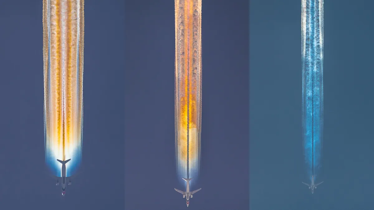
There are also other types of clouds, but they're special cases that generally fall outside of this classification system. These include lenticular clouds (ones that look like UFOs over mountains), mammatus clouds (lumpy, dense clouds frequently associated with cumulonimbus clouds), and contrails (condensation trails produced by airplanes).
Do other planets have clouds?
Yes! Clouds are not exclusive to Earth. According to the University of California, Santa Barbara, all planets except Mercury have clouds — and some of these clouds do contain traces of water, usually in the form of ice crystals. What makes Earth's clouds stand out is that they're made almost entirely from water, whereas the clouds from other planets typically comprise various gases.
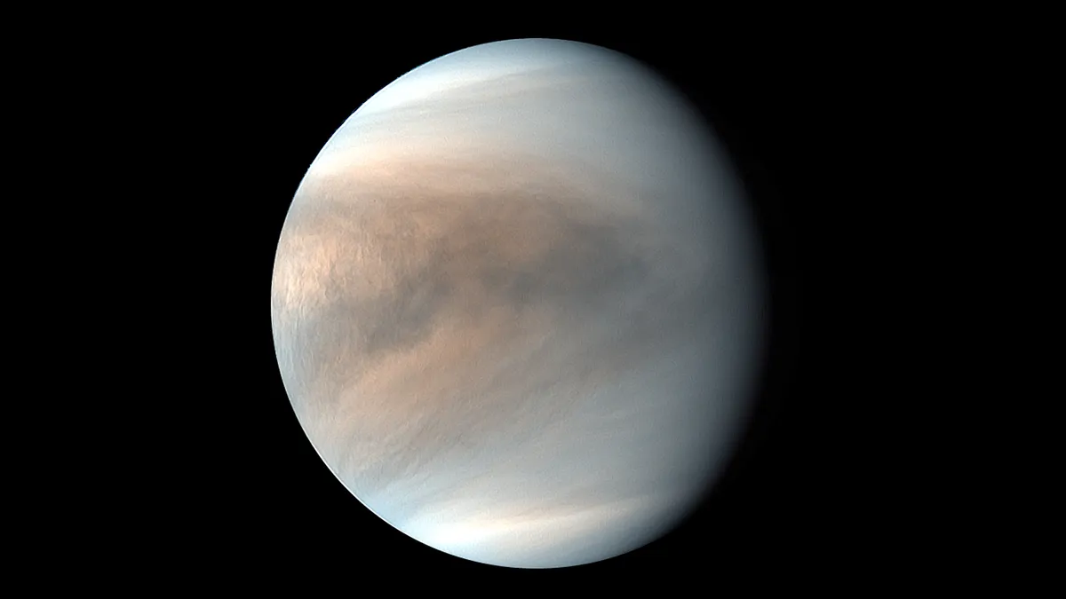
Clouds on our neighboring planets have vastly different compositions. On Jupiter, for instance, the clouds are primarily made of ammonia ice and ammonium hydrosulfide whereas Venus' clouds are made of sulfuric acid.
Then outside our solar system, some exoplanets are known to have clouds. Per NASA's Jet Propulsion Laboratory (JPL), those clouds are frequently made from silicates, which are minerals that form the majority of the Earth's crust. In essence, these clouds are made of sand.
Cloud types FAQs
What are the four main types of clouds?
The four main types of clouds are cumulus, cirrus, stratus, and nimbus.
How many types of clouds are there?
The four main types of clouds have been expanded into 10 classifications in the WMO's International Cloud Atlas. But there are many special clouds beyond these classifications.
What are the fluffy clouds called?
The small, white fluffy clouds that appear in clusters are cumulus clouds. The large tower-like and anvil-shaped fluffy clouds are cumulonimbus clouds, also known as thunderstorm clouds.
Cloud Q&A with an expert

James LaDue is Acting Director of the National Windstorm Impact Reduction Program (NWIRP) in the Engineering Laboratory at the National Institute of Standards and Technology (NIST); Member of the American Meteorological Society (AMS), American Society for Civil Engineers (ASCE), and the National Weather Association (NWA).
We asked meteorologist James LaDue, Acting Director of the National Windstorm Impact Reduction Program (NWIRP) in the Engineering Laboratory at the National Institute of Standards and Technology (NIST), a few frequently asked questions about clouds.
Why are there so many different types of clouds?
This is a most fundamental question whose answer is complex. You take a simple concept that clouds form from cooling an air parcel's temperature until the water vapor within it condenses onto small particles (of dust, salt, biologicals) that exist everywhere to create clouds of water. But then add that if the atmosphere is cold enough then the water vapor deposits onto particles as ice crystals instead of liquid cloud drops. So now you have clouds of ice crystals that look quite different than liquid drops because they don't disappear so quickly when mixed with drier air. Ice crystal clouds likely persist where the individual crystals slowly fall out into curtain-like veils and you get mares tails.
Among all clouds, the act of cooling the air sounds simple but there are so many ways to perform the act. At night near the ground, the air cools quickly as infrared radiation escapes into space and fog forms. Or warm air could travel over a cool surface and the same thing happens. Or the fog could turn into low stratus. The air isn't rising quickly; it's mostly traveling horizontally. So the fog or low stratus is flat and uniform in appearance. Aloft air that's softly rising in a stable atmosphere will create sheets of uniform-looking clouds like stratus, altostratus, or, in the case of ice crystals, cirrostratus. Each of these looks different because of their altitude and whether or not they're liquid droplets or ice crystals.
Then if you add atmospheric buoyancy, like when there is strong heating below or strong cooling aloft, air parcels may erupt quickly upwards and downwards in an attempt to stabilize the atmosphere. Well, out goes any flat uniform appearance and in comes the cellular, cumuliform, appearance. If the heating starts at the ground, then you get the fair weather clumpy cumulus clouds. Since condensation (or deposition of ice crystals) occurs, the very act heats the air and can cause buoyant parcels. Now you can get altocumulus and cirrocumulus. Enough buoyancy and the altocumulus becomes altocumulus castellanus — tall buoyant plumes with flat stratiform bases — because the initial cloud can form as altostratus, and then the heat of condensation causes the top of the clouds to turn into cumulus.
If the rate of temperature decrease in the atmosphere is high and deep enough, and there's enough moisture to really heat a rising air parcel, these cumulus turn into cumulonimbus from which showers and thunderstorms form. The storms may form from cumulus, or altocumulus, or you may not see them because the buoyant parcels form above altostratus. Thunderstorms are really effective at spewing moisture upwards and downwards, which generates all sorts of mechanisms to produce all sorts of cloud species. Their tops spread outwards to form anvils of thick cirrus clouds. But the thunderstorms spawn cold air that spreads outwards forming cold fronts that lift air along their edges to create shelf clouds.
And out of all of this, I haven't even discussed that clouds may consist of stuff other than water!
Why are clouds white (or, in some cases, dark gray)?
Clouds are white when liquid and ice droplets scatter the sun's rays in all different directions equally for all of the colors that make up white sunlight. The only catch is that scattered light has to reach your eyes with the same brightness as the incoming sunlight. If your eyes are below a cloud that's thick enough to absorb some of that scattered light, then the brightness goes down and you get gray clouds. Note that gray still means that all of the colors of sunlight are roughly equally absorbed.
Sometimes sunlight doesn't scatter light equally in all directions. So a thin stratus or altostratus cloud with similar-sized droplets scatters light mostly in a forward direction in a mechanism called Mie scattering. Sometimes you're in an airplane looking at these clouds, and they look grey despite them being small and thin. But somebody on the ground underneath the same cloud may see the same cloud appearing white..
Clearly cloud density and thickness affect how much sunlight is absorbed. The thicker and denser the cloud, the darker its base becomes, like in a cumulonimbus cloud (thunderstorm). Clearly someone looking at a thunderstorm cumulonimbus from the side illuminated by the sun will see a very bright cloud, because all those liquid and ice crystals are so effective at reflecting light backward and to the side.
So I mentioned scattering, reflection, and absorption. All these processes affect how clouds appear. The Mie scattering doesn't change the color of the light, but the direction has a preference for certain clouds. Reflection of sunlight is light bounced back from larger surfaces, perhaps ice crystals and raindrops. Absorption is when incident light is absorbed by an object and converted to heat, no scattering or reflection.
What effect do clouds have on our climate?
Clouds keep us from being cooked alive. If there were no clouds in our atmosphere then no sunlight would be scattered/reflected back into space and we would heat up to intolerable levels (everything else left the same). Yay for clouds!
However, the elevation at which clouds form and the types of clouds affect the cooling and heating of the atmosphere. This is because clouds scatter visible and infrared light at different levels. For example, thin cirrus clouds don't absorb and scatter sunlight very efficiently because they appear translucent. So sunlight gets down to the surface. The surface warms and emits infrared light upward only to encounter cirrus clouds which look opaque in that wavelength. So the cirrus cloud absorbs and re-emits the infrared light back to the ground and the heat is trapped. Cirrus clouds keep the lower atmosphere warm.
On the other hand, liquid clouds cool the lower atmosphere because their density efficiently reflects sunlight back into space. Of course, clouds of all types do trap the infrared light in the lower atmosphere and thus result in warmth at night, but the atmosphere above liquid clouds can cool quickly.
The research on how clouds help or hinder global warming is becoming clearer. The latest research suggests we'll get higher cirrus clouds, which effectively allows sunlight in to heat the atmosphere while trapping infrared; this is a positive for enhancing warming. Meanwhile, a warming atmosphere reduces liquid cloud cover which could reflect sunlight away.
How have satellites helped our understanding of clouds?
They are crucial. Polar-orbiting and geostationary satellites provide continuous coverage of clouds using sensors that detect light from multiple thermal infrared and visible wavelengths. The intensity of the light detected from these multiple wavelengths can be converted to give us a lot of quantitative information about the global heat exchanges, the level of solar incoming light, and the outgoing terrestrial infrared light. This helps climate scientists track our heat balances and how clouds affect them.
On the meteorological side, satellites provide information to understand the atmospheric patterns that develop clouds. Through our observations of clouds, meteorologists can detect the atmospheric processes that create the clouds. They use the clouds to analyze atmospheric motion and storm systems. With other observations to assist, they can use the clouds to make forecasts of future clouds and their attendant hazards. Consider tropical storms: before the satellite era, numerous tropical storms went undetected until they came perilously close to shore. Now that's not the case.
Additional resources
See examples of the different types of clouds in this video by NOAA. Download the CloudSpotter app to help you identify clouds on the go. If you're a budding astronomer and want some tips on what to do when it's cloudy, this article by OPT Telescopes has some helpful advice!
Bibliography
Are there clouds on other planets? UCSB. Retrieved Oct. 4, 2023, from http://scienceline.ucsb.edu/getkey.php?key=884
Cloud. Merriam-Websiter. Retrieved Oct. 4, 2023, from https://www.merriam-webster.com/dictionary/cloud
How Clouds Form. NOAA. Retrieved Oct. 4, 2023, from https://www.noaa.gov/jetstream/clouds/how-clouds-form
The Importance of Understanding Clouds. NASA. Retrieved Oct. 4, 2023, from https://www.nasa.gov/wp-content/uploads/2015/03/135641main_clouds_trifold21.pdf
International Cloud Atlas Manual on the Observation of Clouds and Other Meteors (WMO-No. 407). WMO. Retrieved Oct. 4, 2023, from https://cloudatlas.wmo.int/en/home.html
Jupiter Facts. NASA. Retrieved Oct. 4, 2023, from https://science.nasa.gov/jupiter/facts/
NASA Helps Decipher How Some Distant Planets Have Clouds of Sand. NASA. Retrieved Oct. 4, 2023, from https://www.jpl.nasa.gov/news/nasa-helps-decipher-how-some-distant-planets-have-clouds-of-sand
Venus Facts. NASA. Retrieved Oct. 4, 2023, from https://science.nasa.gov/venus/facts/
What Makes It Rain? NOAA Scijinks.Retrieved Oct. 4, 2023, from https://scijinks.gov/rain/