Astronaut Spots Tropical Storm Barry Menacing the Gulf Coast
Breaking space news, the latest updates on rocket launches, skywatching events and more!
You are now subscribed
Your newsletter sign-up was successful
Want to add more newsletters?
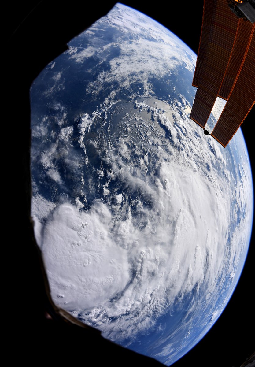
A host of weather satellites — and at least one astronaut — are keeping their eyes on Tropical Storm Barry as it approaches the Gulf Coast.
Barry is marching slowly northwestward toward the Louisiana coast today (July 12) and is expected to head north and inland over the lower Mississippi Valley tomorrow, according to a public advisory issued by the National Oceanic and Atmospheric Administration's National Hurricane Center.
The winds of a tropical storm are much weaker than those of a hurricane, but the key threat is what stands out in a photo NASA astronaut Christina Koch shared on Twitter from her vantage point on the International Space Station: a vast spread of clouds.
Article continues belowRelated: Hurricane Watch: How Satellites Track Huge Storms from Space
Those clouds threaten parts of Louisiana and Mississippi with 10 to 20 inches (25 to 50 centimeters) of rain, with a few locations perhaps seeing 25 inches (64 cm), according to the National Hurricane Center. Storm surge, gusts of winds and a few tornadoes are also potential consequences of the storm that the center is monitoring.
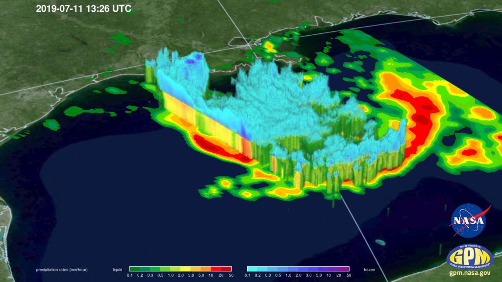
The National Hurricane Center relies in part on a host of satellites to predict where tropical storms and hurricanes will form, how they will develop and where they will end up posing a threat. One of those satellites is a joint project between NASA and the Japan Aerospace Exploration Agency called GPM Core Observatory.
That satellite uses a microwave instrument to estimate how much rain will be produced by the moisture in the clouds. It also uses a radar instrument to measure the height of the cloud tops, which scientists can use to evaluate the risk of thunderstorms.
Breaking space news, the latest updates on rocket launches, skywatching events and more!
- Climate Change Made Recent Hurricanes Wetter. And They May Get Worse.
- Astronaut's Rare Thunderstorm Photos from Space Reveal Stormy Science
- 4 Powerful Storms Seen from Space in 1 Day
Email Meghan Bartels at mbartels@space.com or follow her @meghanbartels. Follow us on Twitter @Spacedotcom and on Facebook.

Meghan is a senior writer at Space.com and has more than five years' experience as a science journalist based in New York City. She joined Space.com in July 2018, with previous writing published in outlets including Newsweek and Audubon. Meghan earned an MA in science journalism from New York University and a BA in classics from Georgetown University, and in her free time she enjoys reading and visiting museums. Follow her on Twitter at @meghanbartels.


