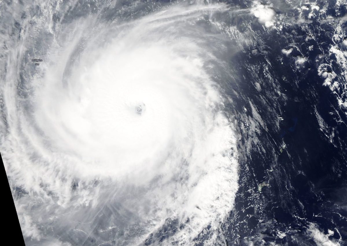
Super Typhoon Yutu Looks Menacing from Space

Weather satellites are monitoring Typhoon Yutu, a monster storm that has threatened land across the western Pacific Ocean.
Those satellites began monitoring the storm almost a week ago, when it first began gathering strength east of Guam. The storm intensified rapidly, becoming a Category 5 typhoon (the term for hurricanes in the Pacific Ocean) in less than a day and a half.
Typhoon Yutu has already hit the U.S. territory of the Northern Mariana Islands, where the effects were predicted to be catastrophic. According to NASA, it was this year's strongest hurricane upon landfall anywhere in the U.S.
The storm has weakened somewhat since that impact and was a Category 4 storm as of today (Oct. 26). According to NASA, the storm is expected to remain a typhoon until the middle of next week.
At around the same time, Yutu is expected to reach the northern Philippines, Taiwan and southeastern China.
The satellites meteorologists are relying on to track the huge storm include Suomi NPP, which is jointly managed by NASA and the National Oceanic and Atmospheric Administration, Japan's Himawari-8 satellite and the Global Precipitation Measurement satellite that is operated by NASA and its Japanese equivalent.
Email Meghan Bartels at mbartels@space.com or follow her @meghanbartels. Follow us @Spacedotcom and Facebook. Original article on Space.com.
Breaking space news, the latest updates on rocket launches, skywatching events and more!

Meghan is a senior writer at Space.com and has more than five years' experience as a science journalist based in New York City. She joined Space.com in July 2018, with previous writing published in outlets including Newsweek and Audubon. Meghan earned an MA in science journalism from New York University and a BA in classics from Georgetown University, and in her free time she enjoys reading and visiting museums. Follow her on Twitter at @meghanbartels.

