Weakening Hurricane Michael Swirls Over North Carolina in Satellite Images
Breaking space news, the latest updates on rocket launches, skywatching events and more!
You are now subscribed
Your newsletter sign-up was successful
Want to add more newsletters?
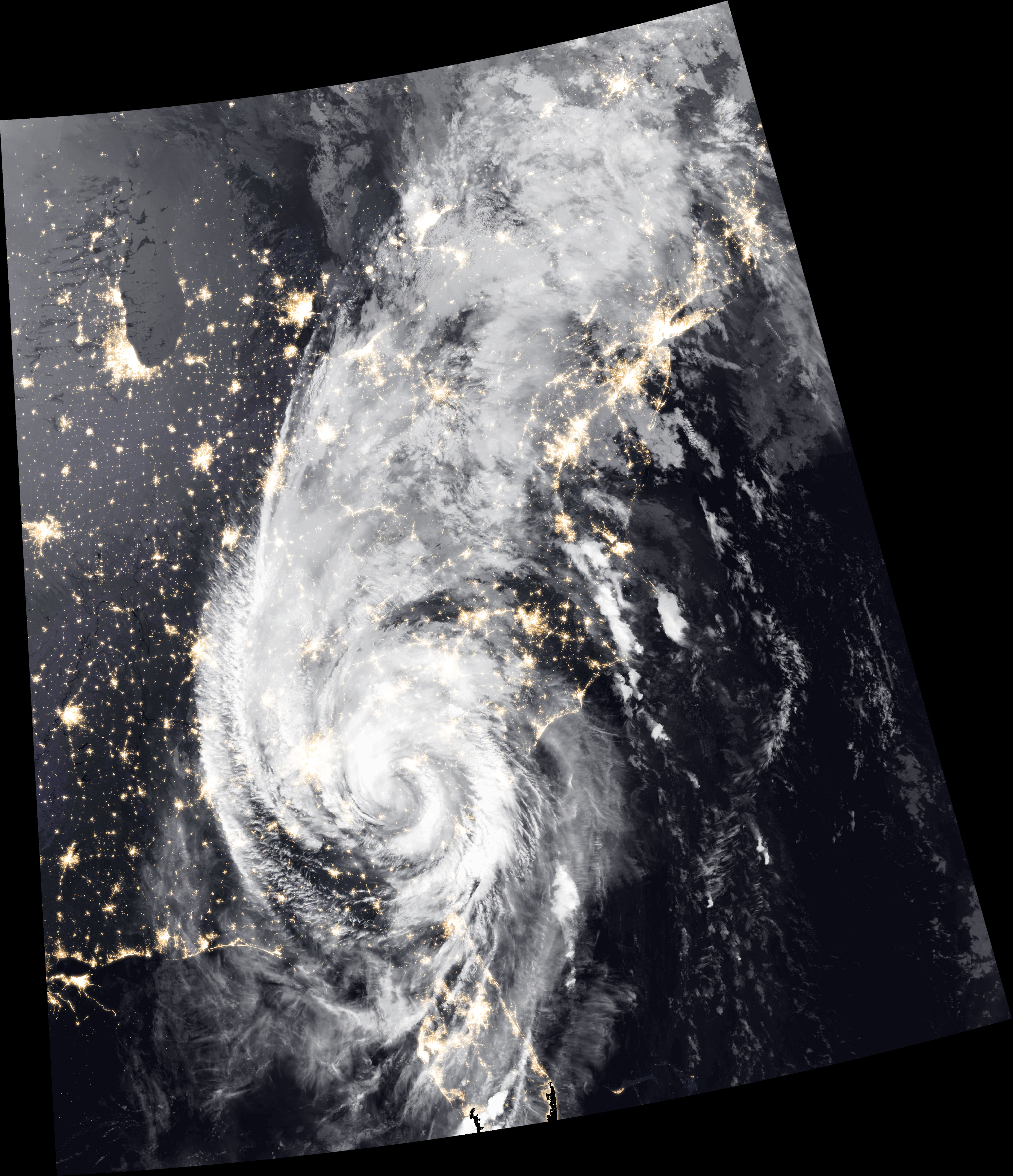
Weather satellites tracking monster Hurricane Michael captured this incredible view of the storm's clouds over North Carolina early yesterday morning (Oct. 11).
Michael barrelled across the southern U.S. on Wednesday (Oct. 10), beginning the day as a Category 4 hurricane and rapidly losing wind strength as it traveled. In its violent battering of the southeastern U.S., Hurricane Michael left floodwaters, wind-wrecked buildings and power outages in its wake. The current death toll from the storm is 11, although emergency responders say that number could still rise.
But even as affected communities evaluate the damage left in the storm's wake, weather satellites continued to monitor Michael's progress.
Article continues belowThis image was created using infrared measurements from the Suomi NPP weather satellite, which orbits Earth pole to pole. Studying storms in that wavelength of light allows scientists to understand cloud structure in particularly fine detail, according to a statement released by NASA to accompany the image.
As of this morning, Michael is a post-tropical storm off the Eastern Seaboard. But it is expected to continue its rapid travels, reaching the northwest coast of Spain on Monday, according to current predictions from the National Oceanic and Atmospheric Administration's National Hurricane Center.
Email Meghan Bartels at mbartels@space.com or follow her @meghanbartels. Follow us @Spacedotcom and Facebook. Original article on Space.com.
Breaking space news, the latest updates on rocket launches, skywatching events and more!

Meghan is a senior writer at Space.com and has more than five years' experience as a science journalist based in New York City. She joined Space.com in July 2018, with previous writing published in outlets including Newsweek and Audubon. Meghan earned an MA in science journalism from New York University and a BA in classics from Georgetown University, and in her free time she enjoys reading and visiting museums. Follow her on Twitter at @meghanbartels.

