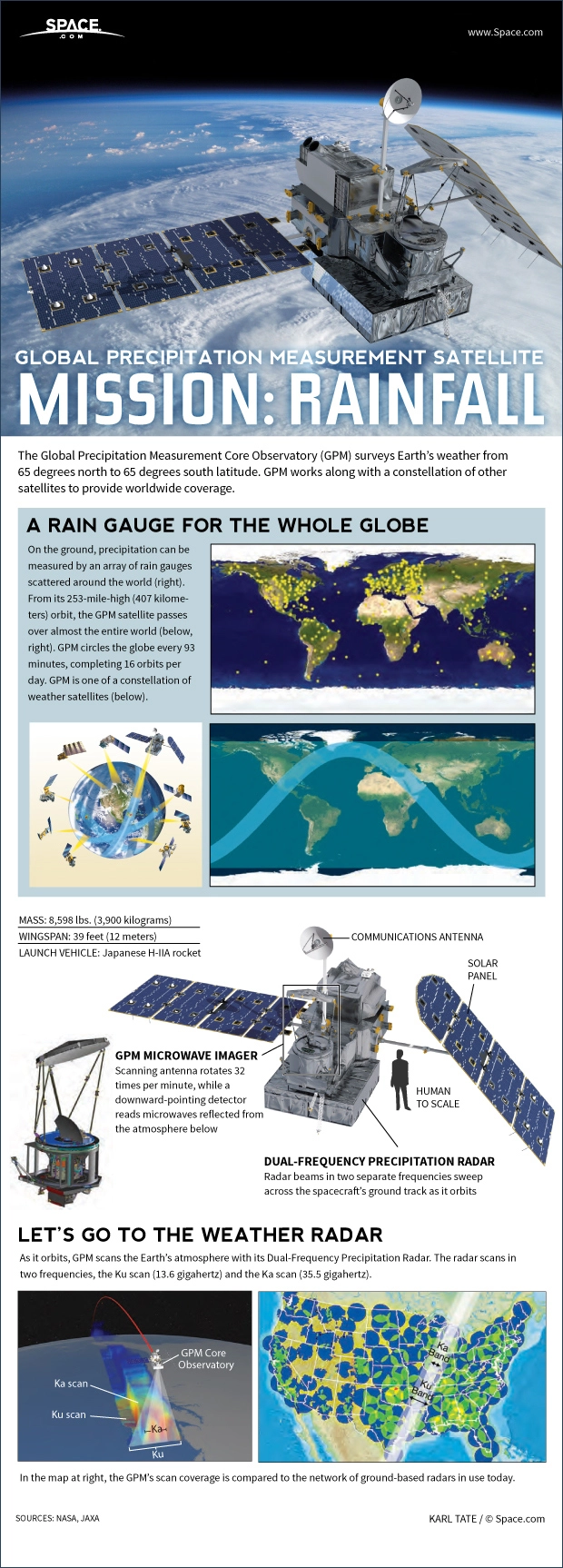
The Global Precipitation Measurement Core Observatory (GPM) surveys Earth’s weather from 65 degrees north to 65 degrees south latitude. GPM works along with a constellation of other satellites to provide worldwide coverage.
On the ground, precipitation can be measured by an array of rain gauges scattered around the world. From its 253-mile-high (407 kilometers) orbit, the GPM satellite passes over almost the entire world. GPM circles the globe every 93 minutes, completing 16 orbits per day. GPM is one of a constellation of weather satellites.
GPM has a mass of 8,598 lbs. (3,900 kilograms). Its wingspan across the solar panels is 39 feet (12 meters). It is launched on a Japanese H-IIA rocket.
The satellite carries a microwave imager. Its ccanning antenna rotates 32 times per minute, while a downward pointing detector reads microwaves reflected from the atmosphere below.
As it orbits, GPM scans the Earth’s atmosphere with its Dual-Frequency Precipitation Radar. The radar scans in two frequencies, the Ku scan (13.6 gigahertz) and the Ka scan (35.5 gigahertz).
