Photos: NASA's Advanced Landsat Earth-Watching Satellite
Landsat 8's First Year: Views of United States
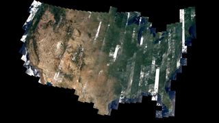
The map above—one of the first complete views of the United States from Landsat 8—is an example of how scientists are testing Landsat 8 data. David Roy, a co-leader of the USGS-NASA Landsat science team and researcher at South Dakota State University, made the map with observations taken during August 2013 by the satellite’s Operational Land Imager. The strips in the image above are a result of the way Landsat 8 operates. Like its predecessors, Landsat 8 collects data in 185-kilometer (115-mile) wide strips called swaths or paths.
Landsat Data Continuity Mission LDCM Spacecraft Lifted to the Top
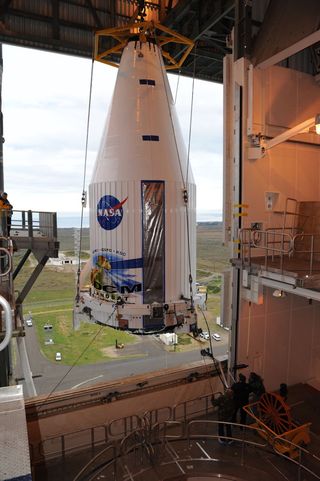
The payload faring containing the Landsat Data Continuity Mission LDCM spacecraft is lifted to the top of Space Launch Complex-3E at Vandenberg Air Force Base where it will be hoisted atop a United Launch Alliance Atlas V for launch. Image released Jan. 25, 2013.
Landsat Data Continuity Mission LDCM Spacecraft Hoisted Aloft
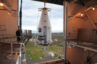
The payload faring containing the Landsat Data Continuity Mission LDCM spacecraft is lifted to the top of Space Launch Complex-3E at Vandenberg Air Force Base where it will be hoisted atop a United Launch Alliance Atlas V for launch. Image released Jan. 25, 2013.
Landsat Data Continuity Mission LDCM Spacecraft Lifted
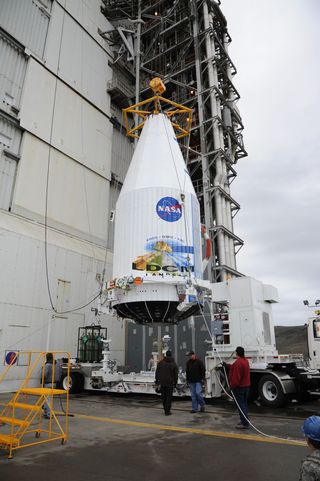
-The payload faring containing the Landsat Data Continuity Mission LDCM spacecraft is lifted from a transporter at Vandenberg Air Force Base's Space Launch Complex-3E where it will be hoisted atop a United Launch Alliance Atlas V for launch. Image released Jan. 25, 2013.
LCDM Payload in Partial Shadow
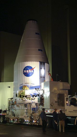
The payload faring containing the Landsat Data Continuity Mission LDCM spacecraft leaves the Astrotech processing facility at Vandenberg Air Force Base in California and heads toward the launch pad at Space Launch Complex-3E. There it will be hoisted atop a United Launch Alliance Atlas V for launch. Image released Jan. 25, 2013.
Landsat Data Continuity Mission LDCM Spacecraft Rolls Out
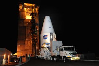
The payload faIring containing the Landsat Data Continuity Mission spacecraft arrives at Vandenberg Air Force Base's Space Launch Complex-3E where it will be hoisted atop a United Launch Alliance Atlas V for launch. Image released Jan 25, 2013.
Landsat Data Continuity Mission LDCM Spacecraft Departs Processing Facility
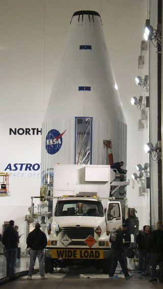
The payload faring containing the Landsat Data Continuity Mission LDCM spacecraft departs the Astrotech processing facility at Vandenberg Air Force Base in California and heads toward the launch pad at Space Launch Complex-3E. There it will be hoisted atop a United Launch Alliance Atlas V for launch. Image released Jan. 25, 2013.
Get the Space.com Newsletter
Breaking space news, the latest updates on rocket launches, skywatching events and more!
Landsat Celebrates 40 Years of Observing Earth
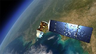
An artist's rendition of the next Landsat satellite, the Landsat Data Continuity Mission (LDCM) that will launch in Feb. 2013.
LDCM Spacecraft
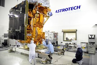
Technicians begin checkout of NASA's Landsat Data Continuity Mission, or LDCM, satellite at the Astrotech facility at Vandenberg Air Force Base in California where it will undergo prelaunch processing.
Fairing Encloses Landsat Satellite
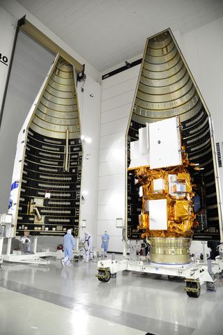
Technicians encapsulate NASA's Landsat Data Continuity Mission (LDCM) satellite in its payload fairing in the Astrotech processing facility at Vandenberg Air Force Base in California on Feb. 7, 2013.
Landsat Data Continuity Mission Environmental Testing is Underway
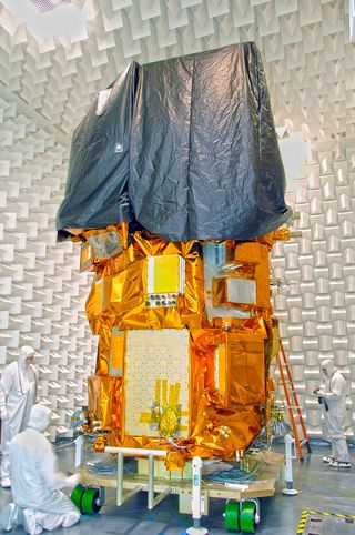
Landsat Data Continuity Mission (LDCM) Observatory Electromagnetic Interference/Electromagnetic Compatibility (EMI/EMC) testing is underway at Orbital Science Corporation's Gilbert, Ariz., location. This image was taken Aug. 7, 2012.
Join our Space Forums to keep talking space on the latest missions, night sky and more! And if you have a news tip, correction or comment, let us know at: community@space.com.

Space.com is the premier source of space exploration, innovation and astronomy news, chronicling (and celebrating) humanity's ongoing expansion across the final frontier. Originally founded in 1999, Space.com is, and always has been, the passion of writers and editors who are space fans and also trained journalists. Our current news team consists of Editor-in-Chief Tariq Malik; Editor Hanneke Weitering, Senior Space Writer Mike Wall; Senior Writer Meghan Bartels; Senior Writer Chelsea Gohd, Senior Writer Tereza Pultarova and Staff Writer Alexander Cox, focusing on e-commerce. Senior Producer Steve Spaleta oversees our space videos, with Diana Whitcroft as our Social Media Editor.