How NASA Is Using Lasers to Study Climate Change (Video)
Lush regions like the Amazon rainforest help filter the air on Earth, and in a new video, NASA explains how its collaboration with Brazilian scientists is monitoring these precious trees in 3D.
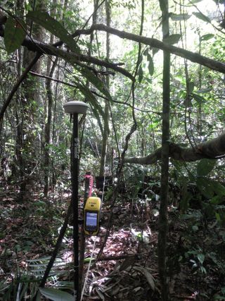
Researchers from NASA's Goddard Space Flight Center in Maryland worked with scientists at the Brazilian Agricultural Research Corporation and the Federal University of Western Pará in a "painstaking effort to measure downed branches and trees," according to a recent statement from NASA, which released the video. As Brazilian researchers studied the rainforest from the ground, NASA Goddard researchers flew a plane over the canopy (the treetops) and used pulses of laser light to measure the fallen branches and trees over the course of several years.

Drought brought on by climate change can cause large trees in a rainforest to die. To obtain a 3D view of dying trees, NASA scientists mounted light detection and ranging (lidar) technology onto an airplane. Pulsing 300,000 times per second, the lidar tech swept over two 30-mile (50 kilometers) swaths of the Amazon rainforest near Santarém, Brazil. One was a section of the Tapajós National Forest, and the other was an area of privately owned forests that were "fragmented by a range of land uses," NASA officials said.
From that information, scientists could estimate how much carbon dioxide failed to be absorbed as a result of dead vegetation in the multi-layered rainforest.

The researchers found that tree and branch mortality was 65 percent higher during the El Niño drought period from 2014 to 2016, totaling about 65,000 square miles (168,000 square km). And if tree decline continues, more carbon dioxide subsequently gets left in Earth's atmosphere, which, in turn, feeds the greenhouse cycle that can cause more droughts in the future, NASA officials said.
The researchers published a paper on their findings in March in the journal New Phytologist.
Follow Doris Elin Salazar on Twitter @salazar_elin. Follow us @Spacedotcom, Facebook and Google+. Original article on Space.com.
Get the Space.com Newsletter
Breaking space news, the latest updates on rocket launches, skywatching events and more!
Join our Space Forums to keep talking space on the latest missions, night sky and more! And if you have a news tip, correction or comment, let us know at: community@space.com.

Doris is a science journalist and Space.com contributor. She received a B.A. in Sociology and Communications at Fordham University in New York City. Her first work was published in collaboration with London Mining Network, where her love of science writing was born. Her passion for astronomy started as a kid when she helped her sister build a model solar system in the Bronx. She got her first shot at astronomy writing as a Space.com editorial intern and continues to write about all things cosmic for the website. Doris has also written about microscopic plant life for Scientific American’s website and about whale calls for their print magazine. She has also written about ancient humans for Inverse, with stories ranging from how to recreate Pompeii’s cuisine to how to map the Polynesian expansion through genomics. She currently shares her home with two rabbits. Follow her on twitter at @salazar_elin.
