Ariane 5 Rocket Launches 4 More Satellites for Europe's GPS Network
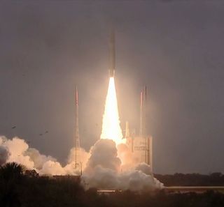
A European Ariane 5 rocket shot skyward from the small South American country of French Guiana this afternoon (Dec. 12), carrying four new navigation satellites into orbit for the European Space Agency.
The rocket, built by European launch provider Arianespace, lifted off from the Guiana Space Center in Korou at 1:36:07 p.m. EST (1836:07 GMT and 3:36:07 p.m. in Kourou) with the new Galileo navigation system satellites, which will join 18 already in orbit.
The European Union is adding members to its own satellite-navigation system, the Galileo constellation, which will function much like the United States' Navstar GPS system. The launch occurred just three days before the one-year anniversary of the Galileo constellation turning on.

Unlike GPS, or Russia's GLONASS, Galileo is dedicated to civilian use. The Galileo constellation will eventually comprise 24 satellites and six in-orbit spares, according to ESA. Arianespace has launched 22 of the system's satellites atop Soyuz and Ariane 5 rockets, according to a statement the French company released before the launch.
"And there they go, blazing a trail across the sky here over the spaceport," Arianespace's launch commentator said just as the rocket reached the 10 km mark (6.2 miles).
All processes and checks were automatic from seven minutes before launch until liftoff. About 15 seconds after launch the rocket disappeared into the low clouds above the city of Kourou. After 2 minutes 20 seconds the two solid rocket boosters were jettisoned, followed shortly by the payload fairing, or nose cone, at 3 minutes and 44 seconds. And the main stage was dropped nine minutes into the flight. About 20 minutes after launch the last engine switched off and the satellites sailed toward their final altitude.
The satellites are set to separate 3 hours, 55 minutes and 45 seconds after liftoff, and they will eventually settle into middle-Earth orbit, 14,430 miles (23,222 km) above the planet, with an orbital inclination of 56 degrees to the equator. The European Union selected this orbit to provide better coverage of high latitudes, which aren't served as well by GPS or GLONASS.
Get the Space.com Newsletter
Breaking space news, the latest updates on rocket launches, skywatching events and more!
"Galileo navigation signals will provide good coverage even at latitudes up to 75 degrees north, which corresponds to Norway's North Cape — the most northerly tip of Europe — and beyond," ESA officials said in a description of the program.
In July 2017, ESA transferred responsibility for in-orbit operations to the European Global Navigation Satellite Systems Agency, which oversaw the launch on Thursday. The system went online Dec. 15, 2016, though its services have yet to reach full capacity. It should be completed between 2020 and 2021, ESA officials said.
Email Harrison Tasoff at htasoff@space.com or follow him @harrisontasoff. Follow us @Spacedotcom, Facebook and Google+. Original article on Space.com.
Join our Space Forums to keep talking space on the latest missions, night sky and more! And if you have a news tip, correction or comment, let us know at: community@space.com.

Harrison Tasoff is a science journalist originally from Los Angeles. He graduated from NYU’s Science, Health, and Environmental Reporting Program after earning his B.A. in mathematics at Swarthmore College. Harrison covers an array of subjects, but often finds himself drawn to physics, ecology, and earth science stories. In his spare time, he enjoys tidepooling, mineral collecting, and tending native plants.
Most Popular


